MyTopo
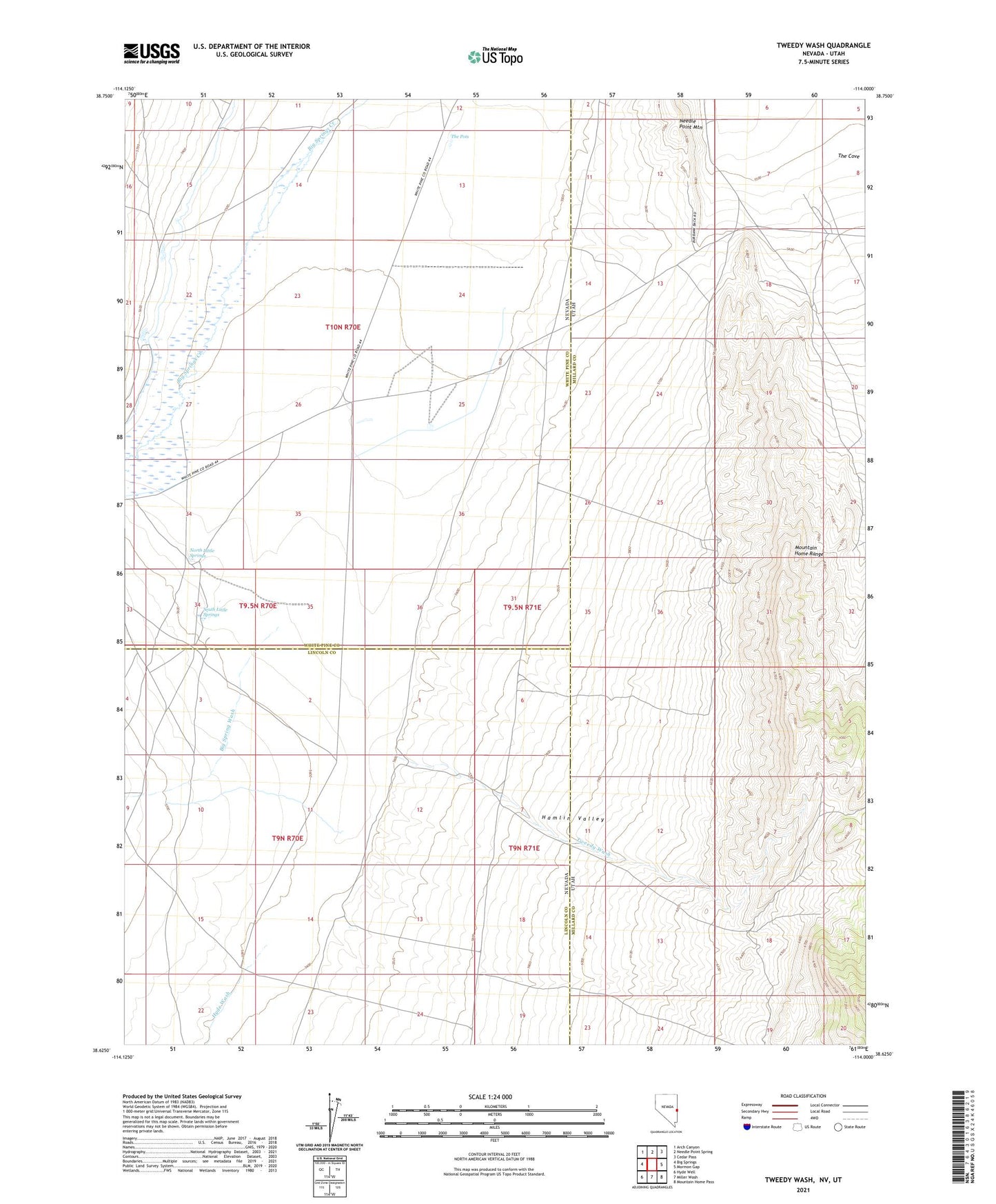
Tweedy Wash Nevada US Topo Map
Couldn't load pickup availability
2021 topographic map quadrangle Tweedy Wash in the states of Nevada, Utah. Scale: 1:24000. Based on the newly updated USGS 7.5' US Topo map series, this map is in the following counties: Lincoln, Millard, White Pine. The map contains contour data, water features, and other items you are used to seeing on USGS maps, but also has updated roads and other features. This is the next generation of topographic maps. Printed on high-quality waterproof paper with UV fade-resistant inks.
Quads adjacent to this one:
West: Big Springs
Northwest: Arch Canyon
North: Needle Point Spring
Northeast: Cedar Pass
East: Mormon Gap
Southeast: Mountain Home Pass
South: Miller Wash
Southwest: Hyde Well
Contains the following named places: Big Spring Wash, Hamblin Valley Flood Water Wash Ditch, Hamlin Valley Wash, Hyde Wash, Needle Point Mountain, North Little Springs, South Little Springs, The Cove, The Pots, Tweedy Wash