MyTopo
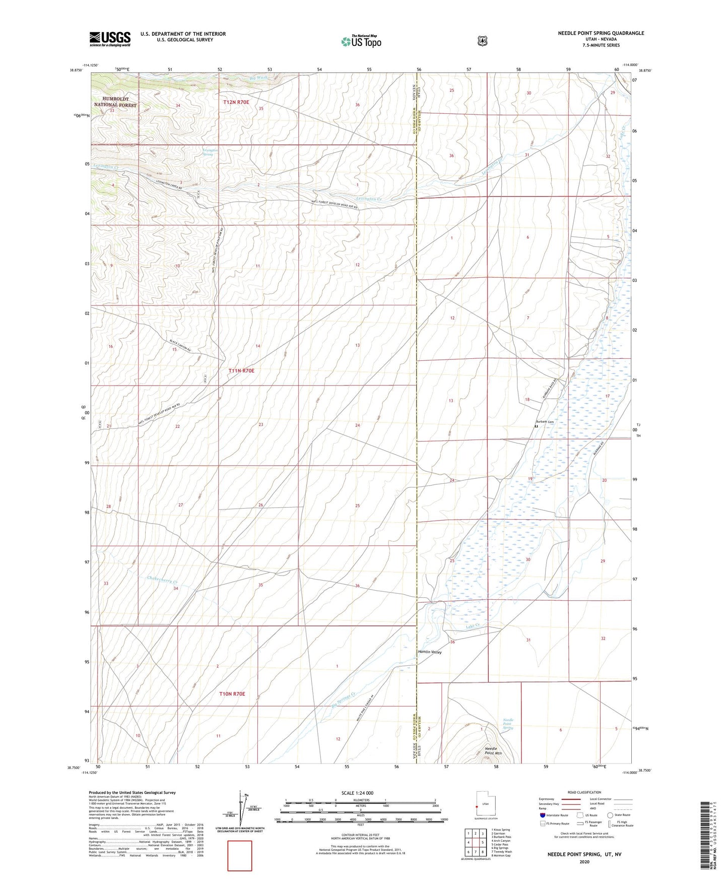
Needle Point Spring Utah US Topo Map
Couldn't load pickup availability
Also explore the Needle Point Spring Forest Service Topo of this same quad for updated USFS data
2023 topographic map quadrangle Needle Point Spring in the states of Nevada, Utah. Scale: 1:24000. Based on the newly updated USGS 7.5' US Topo map series, this map is in the following counties: Millard, White Pine. The map contains contour data, water features, and other items you are used to seeing on USGS maps, but also has updated roads and other features. This is the next generation of topographic maps. Printed on high-quality waterproof paper with UV fade-resistant inks.
Quads adjacent to this one:
West: Arch Canyon
Northwest: Kious Spring
North: Garrison
Northeast: Burbank Pass
East: Cedar Pass
Southeast: Mormon Gap
South: Tweedy Wash
Southwest: Big Springs
This map covers the same area as the classic USGS quad with code o38114g1.
Contains the following named places: Antelope Valley Wash, Big Springs Creek, Burbank, Burbank Cemetery, Chokecherry Creek, Davies Ranch, Dearden Ranch, Hamlin Valley, Lexington Creek, Lexington Spring, Needle Point Spring, Young Ranch