MyTopo
Upsal Hogback Nevada US Topo Map
Couldn't load pickup availability
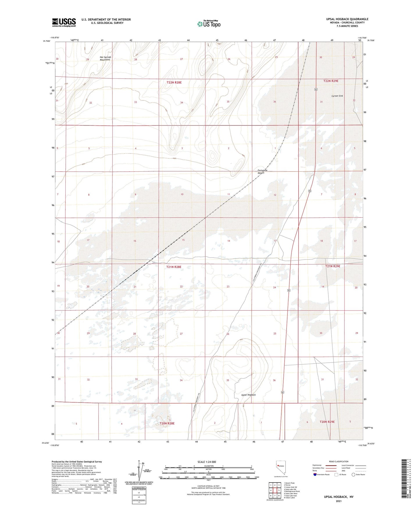
2021 topographic map quadrangle Upsal Hogback in the state of Nevada. Scale: 1:24000. Based on the newly updated USGS 7.5' US Topo map series, this map is in the following counties: Churchill. The map contains contour data, water features, and other items you are used to seeing on USGS maps, but also has updated roads and other features. This is the next generation of topographic maps. Printed on high-quality waterproof paper with UV fade-resistant inks.
Quads adjacent to this one:
West: Soda Lake NW
Northwest: Desert Peak
North: Parran
Northeast: Carson Sink SW
East: Battleground Point
Southeast: Indian Lakes
South: Soda Lake East
Southwest: Soda Lake West
This map covers the same area as the classic USGS quad with code o39118f7.
Contains the following named places: California Emigrant Trail, Desert Siding, Upsal Hogback, Upsal Siding