MyTopo
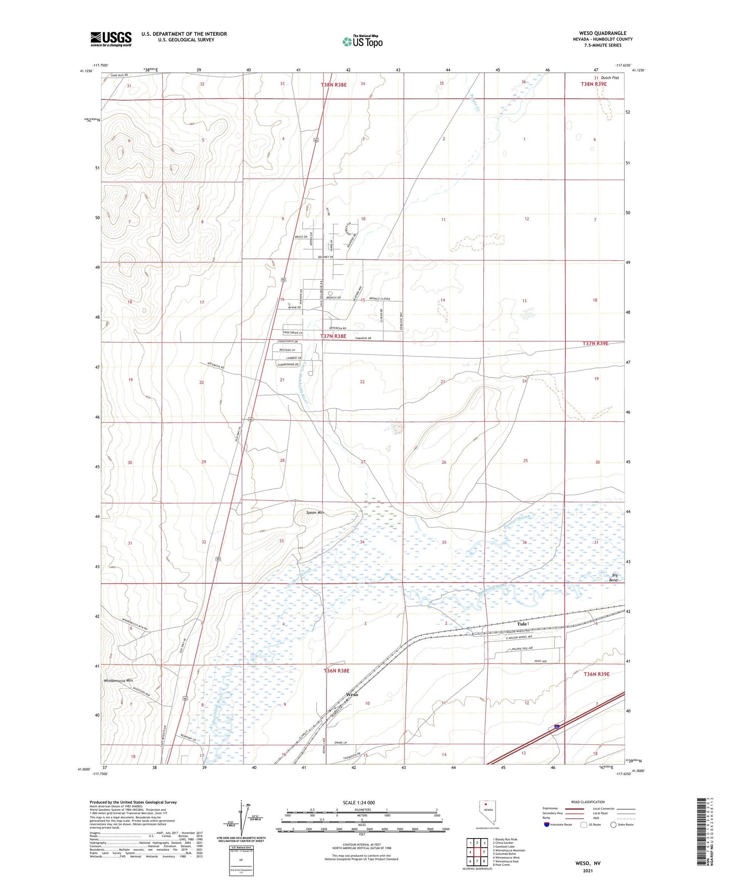
Weso Nevada US Topo Map
Couldn't load pickup availability
2021 topographic map quadrangle Weso in the state of Nevada. Scale: 1:24000. Based on the newly updated USGS 7.5' US Topo map series, this map is in the following counties: Humboldt. The map contains contour data, water features, and other items you are used to seeing on USGS maps, but also has updated roads and other features. This is the next generation of topographic maps. Printed on high-quality waterproof paper with UV fade-resistant inks.
Quads adjacent to this one:
West: Winnemucca Mountain
Northwest: Bloody Run Peak
North: China Garden
Northeast: Gumboot Lake
East: Golconda Butte
Southeast: Pole Creek
South: Winnemucca East
Southwest: Winnemucca West
This map covers the same area as the classic USGS quad with code o41117a6.
Contains the following named places: Baer Ranch Landing Strip, Big Bend, Circle Bar Ranch Landing Strip, Hay Ranch, Humboldt Rifle-Pistol Range, Kearns Well, Little Humboldt River, Paiute Creek, Pioneer Slough, Spoon Mountain, Tollhouse, Tule, Tulls Meadow, Weso