MyTopo
Woody Canyon Nevada US Topo Map
Couldn't load pickup availability
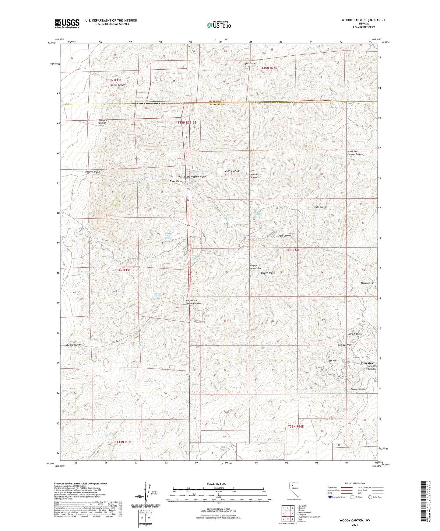
2021 topographic map quadrangle Woody Canyon in the state of Nevada. Scale: 1:24000. Based on the newly updated USGS 7.5' US Topo map series, this map is in the following counties: Pershing, Humboldt. The map contains contour data, water features, and other items you are used to seeing on USGS maps, but also has updated roads and other features. This is the next generation of topographic maps. Printed on high-quality waterproof paper with UV fade-resistant inks.
Quads adjacent to this one:
West: Alpha Mountain
Northwest: Jungo NE
North: Gaskell
Northeast: Pronto
East: Cosgrave
Southeast: Mill City
South: Imlay
Southwest: Rye Patch Reservoir North
This map covers the same area as the classic USGS quad with code o40118g2.
Contains the following named places: Alpha Butte, Blackbird Mine, Bonita Canyon, Bonita Canyon Spring, CCC Spring, Central, Chicken Basin Creek, Chicken Basin Spring, Corral Canyon, Danner Spring, Dry Creek, Eugene Mountains, Forge Mine, Glidden Canyon, Humboldt Hill, Mill City Mining District, Millers Cabin, Millers Spring, Nevada Massachusetts Tungsten Mine, New Central, North Fork Bonita Canyon, North Fork Central Canyon, North Fork Woody Canyon, Red Hawk Mine, Republican Mine, Sage Chicken Spring, Souza Spring, Springer Canyon, Springer Hill, Stank Canyon, Stank Hill, Sutton Hill, Three Forks, Three Forks Spring, Tungsten, Tungsten Post Office, Wheelbarrow Mine, Wolfram Peak, Woody Canyon, Woody Springs