MyTopo
Cosgrave Nevada US Topo Map
Couldn't load pickup availability
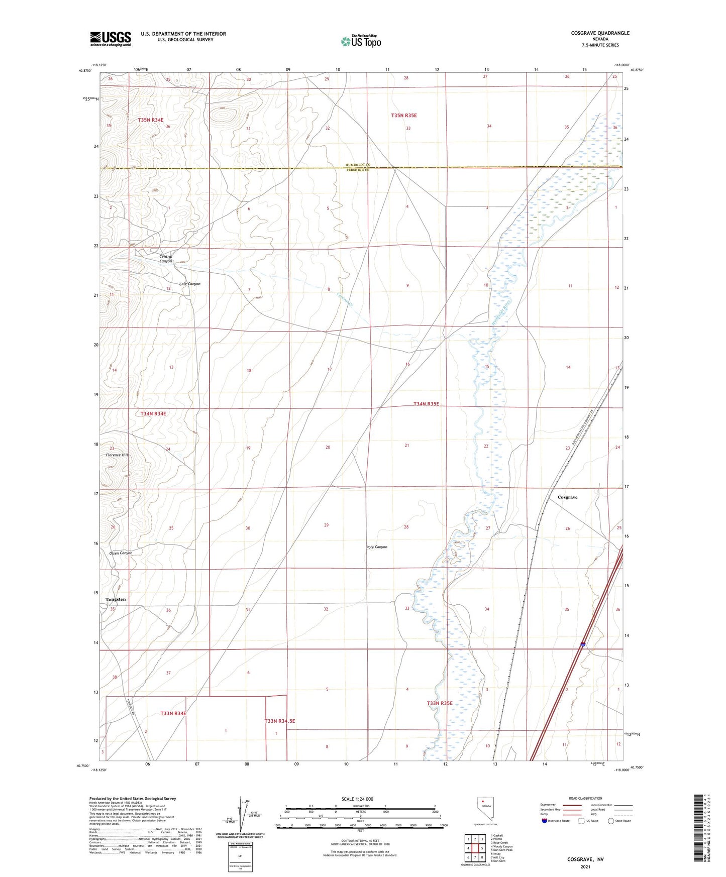
2021 topographic map quadrangle Cosgrave in the state of Nevada. Scale: 1:24000. Based on the newly updated USGS 7.5' US Topo map series, this map is in the following counties: Pershing, Humboldt. The map contains contour data, water features, and other items you are used to seeing on USGS maps, but also has updated roads and other features. This is the next generation of topographic maps. Printed on high-quality waterproof paper with UV fade-resistant inks.
Quads adjacent to this one:
West: Woody Canyon
Northwest: Gaskell
North: Pronto
Northeast: Rose Creek
East: Dun Glen Peak
Southeast: Dun Glen
South: Mill City
Southwest: Imlay
This map covers the same area as the classic USGS quad with code o40118g1.
Contains the following named places: Central Canyon, Central Creek, Central Well, Cole Canyon, Cosgrave, Florence Hill, Gold Coin Mine, Keystone Mine, Olsen Canyon, Pole Canyon, Raspberry Creek, Raspberry Post Office