MyTopo
Andover New Hampshire US Topo Map
Couldn't load pickup availability
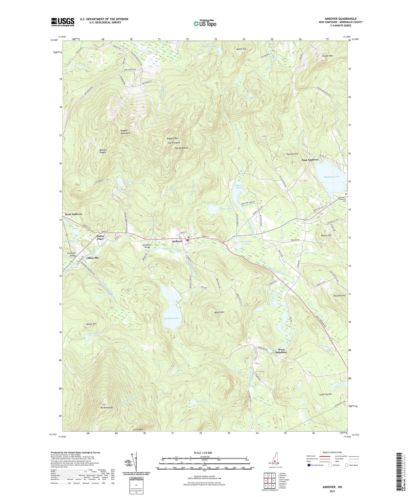
2024 topographic map quadrangle Andover in the state of New Hampshire. Scale: 1:24000. Based on the newly updated USGS 7.5' US Topo map series, this map is in the following counties: Merrimack. The map contains contour data, water features, and other items you are used to seeing on USGS maps, but also has updated roads and other features. This is the next generation of topographic maps. Printed on high-quality waterproof paper with UV fade-resistant inks.
Quads adjacent to this one:
West: New London
Northwest: Grafton
North: Danbury
Northeast: Bristol
East: Franklin
Southeast: Webster
South: Warner
Southwest: Bradford
This map covers the same area as the classic USGS quad with code o43071d7.
Contains the following named places: Adder Pond, Andover, Andover Elementary School, Andover Fire Department, Andover Police Department, Andover Post Office, Beech Hill, Bog Pond, Boston Hill, Bradley Brook, Bradley Lake, Bradley Lake Dam, Buswell Ridges, Cascade Brook, Childrens Camp, Cilleyville, Cilleyville Bridge, Cold Pond, Elbow Pond, Frazier Brook, Gulf Brook, Hameshop Brook, Highland Lake, Horseshoe Pond, Huntoon Pond, Immaculate Conception Church, Johnson Mill Dam, Keniston Bridge, Lake View Cemetery, Little Mountain, Lovering Hill, March Hill, March Pond, Mitchell Brook, Morey Hill, Morey Pond, Morey Pond Dam, Mount Kearsarge, Mount Kearsarge State Forest Park, Mount Kearsarge State Wildlife Management Area, Mountain Brook, Mud Pond, Potter Place, Proctor Academy, Raccoon Hill, Ragged Mountain, Ragged Mountain Club, Ragged Mountain Ski Area, Ragged Mountain State Forest, Ragged Mountains, Taunton Hill, The Bay, The Bulkhead, The Pinnacle, Tilton Brook, Town of Andover, Town of Salisbury, Tucker Mountain, West Salisbury, Wilder Pond, Wilmot Trail, ZIP Codes: 03216, 03231, 03268