MyTopo
Bartlett New Hampshire US Topo Map
Couldn't load pickup availability
Also explore the Bartlett Forest Service Topo of this same quad for updated USFS data
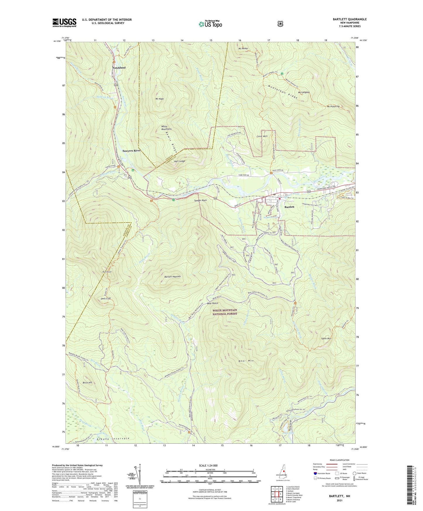
2024 topographic map quadrangle Bartlett in the state of New Hampshire. Scale: 1:24000. Based on the newly updated USGS 7.5' US Topo map series, this map is in the following counties: Carroll, Coos, Grafton. The map contains contour data, water features, and other items you are used to seeing on USGS maps, but also has updated roads and other features. This is the next generation of topographic maps. Printed on high-quality waterproof paper with UV fade-resistant inks.
Quads adjacent to this one:
West: Mount Carrigain
Northwest: Crawford Notch
North: Stairs Mountain
Northeast: Jackson
East: North Conway West
Southeast: Silver Lake
South: Mount Chocorua
Southwest: Mount Tripyramid
This map covers the same area as the classic USGS quad with code o44071a3.
Contains the following named places: Albany Brook, Albany Intervale, Bartlett, Bartlett Brook, Bartlett Census Designated Place, Bartlett Experimental Forest, Bartlett Fire Department Station 1, Bartlett First Assembly of God, Bartlett Haystack, Bartlett Post Office, Bear Brook Trail, Bear Mountain, Bear Mountain Ski Trail, Bear Mountain Trail, Bear Notch, Birch Hill, Brunel Trail, Cave Mountain, Church Pond Loop Trail, Cilley Brook, Deer Brook Trail, Falls Pond, Halfway Brook, Hart Ledge, Haskell Brook, Josiah Bartlett Elementary School, Louisville Brook, McKiels Pond, Meadow Brook, Mount Hope, Mount Langdon, Mount Langdon Shelter, Mount Parker, Mount Pickering, Mount Stanton Trail, Mount Tremont, Mount Tremont Trail, Nancy Brook, Nancy Brook Trail, Notchland, Owls Cliff, Passaconaway Trail, Pond Brook, Razor Brook, Razor Brook Trail, Reservoir Trail, Rob Brook, Rob Brook Trail, Rocky Gorge, Rocky Gorge Scenic Area, Sawyer Pond Trail, Sawyer River, Sawyer Rock, Sawyer Rock Picnic Area, Sawyers River, Stony Brook, Table Mountain, ZIP Code: 03812