MyTopo
Mount Tripyramid New Hampshire US Topo Map
Couldn't load pickup availability
Also explore the Mount Tripyramid Forest Service Topo of this same quad for updated USFS data
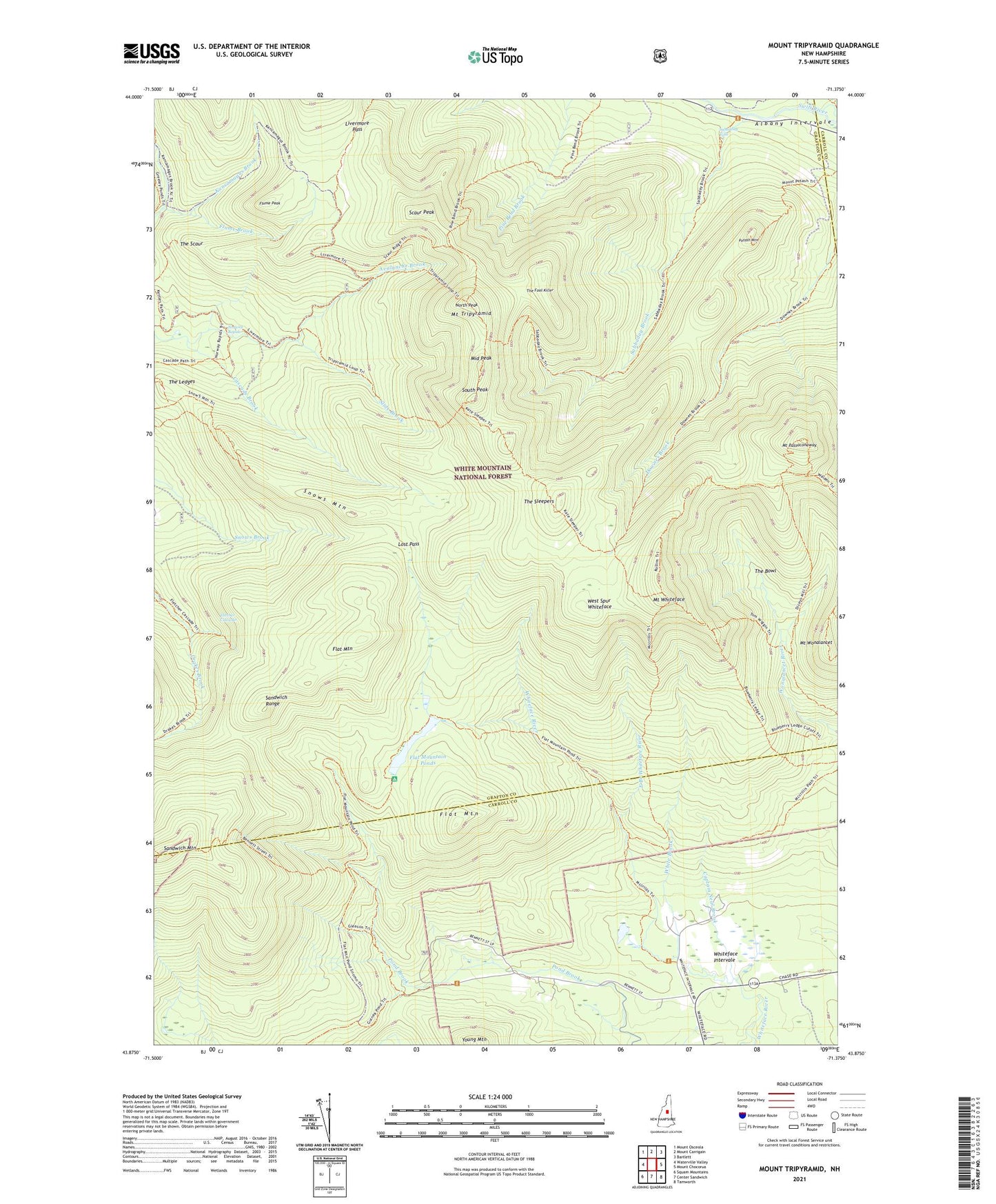
2024 topographic map quadrangle Mount Tripyramid in the state of New Hampshire. Scale: 1:24000. Based on the newly updated USGS 7.5' US Topo map series, this map is in the following counties: Grafton, Carroll. The map contains contour data, water features, and other items you are used to seeing on USGS maps, but also has updated roads and other features. This is the next generation of topographic maps. Printed on high-quality waterproof paper with UV fade-resistant inks.
Quads adjacent to this one:
West: Waterville Valley
Northwest: Mount Osceola
North: Mount Carrigain
Northeast: Bartlett
East: Mount Chocorua
Southeast: Tamworth
South: Center Sandwich
Southwest: Squam Mountains
This map covers the same area as the classic USGS quad with code o43071h4.
Contains the following named places: Avalanche Brook, Bennet ST Trail, Blueberry Ledge Trail, Camp Heermance, Captain Neal Brook, Cold Brook, Cold River, Dicey Mill Trail, Downes Brook Trail, Drakes Brook, Drakes Brook Trail, East Branch Whiteface River, Flat Mountain, Flat Mountain Pond Trail, Flat Mountain Ponds, Flat Pond Shelter, Fletcher Cascades, Flume Brook, Flume Peak, Gleason Trail, Greeley Brook, Kancamagus Brook, Kettles Path, Livermore Pass, Lost Pass, McCrills Trail, Middle Peak, Mount Passaconaway, Mount Tripyramid, Mount Whiteface, Mount Wonalancet, North Peak, North Slide, Norway Rapids, Passaconaway Lodge, Pine Bend Brook Trail, Potash Mountain, Pyramid Loop Trail, Rollins Trail, Sabbaday Brook, Sabbaday Brook Trail, Sabbaday Falls, Sabbaday Falls Picnic Area, Sandwich Mountain, Sandwich Mountain Trail, Sandwich Range, Sandwich Range Wilderness, Scaur Peak, Scaur Trail, Sleeper Trail, Slide Brook, Slide Trail, Slides Downes Brook Trail, Snow Mountain Trail, Snows Brook Trail, Snows Mountain, South Peak, South Slide, The Bowl, The Bowl Natural Area, The Fool Killer, The Ledges, The Scaur, The Sleepers, Town of Waterville Valley, Waterville Valley, West Spur Whiteface, White Brook, Whiteface Intervale, Wigg Trail, Woodbury Trail, Young Mountain, ZIP Codes: 03215, 03259