MyTopo
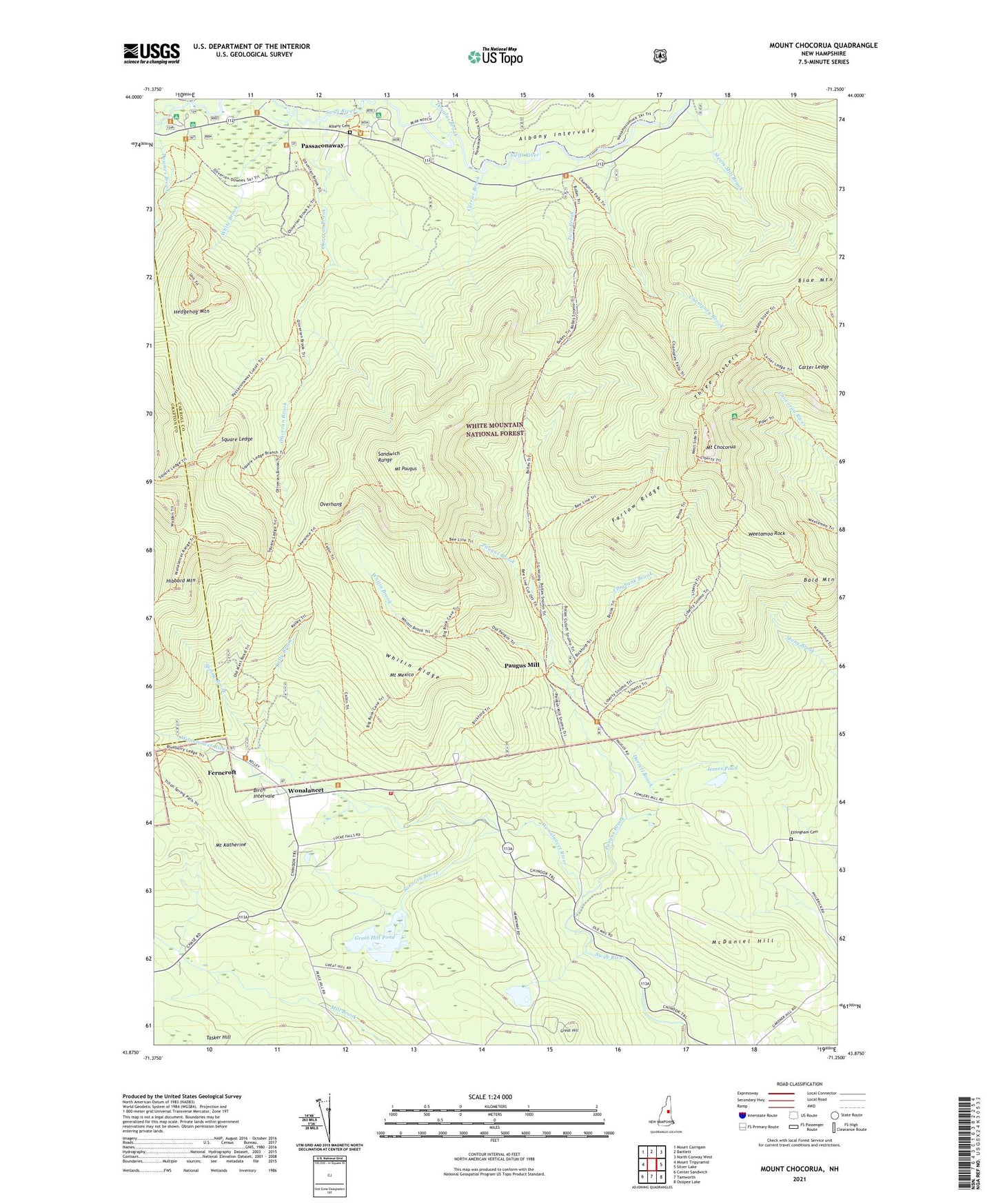
Mount Chocorua New Hampshire US Topo Map
Couldn't load pickup availability
Also explore the Mount Chocorua Forest Service Topo of this same quad for updated USFS data
2024 topographic map quadrangle Mount Chocorua in the state of New Hampshire. Scale: 1:24000. Based on the newly updated USGS 7.5' US Topo map series, this map is in the following counties: Carroll, Grafton. The map contains contour data, water features, and other items you are used to seeing on USGS maps, but also has updated roads and other features. This is the next generation of topographic maps. Printed on high-quality waterproof paper with UV fade-resistant inks.
Quads adjacent to this one:
West: Mount Tripyramid
Northwest: Mount Carrigain
North: Bartlett
Northeast: North Conway West
East: Silver Lake
Southeast: Ossipee Lake
South: Tamworth
Southwest: Center Sandwich
This map covers the same area as the classic USGS quad with code o43071h3.
Contains the following named places: Albany Cemetery, Bald Mountain, Bee Line Trail, Bickford Trail, Big Rock Cave Trail, Birch Intervale, Blue Mountain, Boles Trail, Cabin Trail, Camp Hemenway, Camp Penacook, Carrigain Outlook, Carter Ledge, Champney Brook, Champney Falls Trail, Chocorua Brook Trail, Claybank Brook, Currier Brook, Douglas Brook, Downes Brook, Durrell Brook, Effingham Cemetery, Falls Trail, Farlow Ridge, Ferncroft, Gordon Path, Great Hill, Great Hill Pond, Hammond Trail, Hedgehog Mountain, Hemenway State Reservation, Hibbard Mountain, James Pond, Jigger Johnson Campground, Jigger Jonnson Campground, Kelley Trail, Kelly Brook, Lawrence Trail, Liberty Shelter, Liberty Trail, McDaniel Hill, Mexico Ridge Trail, Middle Sister Trail, Moose Pond, Mount Chocorua, Mount Chocorua Scenic Area, Mount Katherine, Mount Katherine Trail, Mount Mexico, Mount Paugus, Mount Paugus Trail, Old Locke Road Path, Old Mast Road, Old Slag Camp, Oliveran Brook, Oliverian Brook Trail, Overhang, Pass Campground, Passaconaway, Passaconaway Campground, Passaconaway Cutoff Trail, Paugus Brook, Paugus Mill, Red Path, Sanborn Brook, Spring Brook, Square Ledge, Square Ledge Trail, Steam Mill Brook, Tamworth Fire Department Wonalancet Station, Tewksberry Brook, Three Sisters, Tilton Pond, Town of Albany, Twin Brook, U.N.H. Trail, University of New Hampshire Forest Camp, Walden Trail, Weetamoo Rock, White Brook, White Mountain Camp, Whitin Brook, Whitin Brook Trail, Whitin Ridge, Wona Lancet Range Trail, Wonalancet, Wonalancet Range Trail, Wonalancet River, ZIP Code: 03818