MyTopo
Hillsboro Upper Village New Hampshire US Topo Map
Couldn't load pickup availability
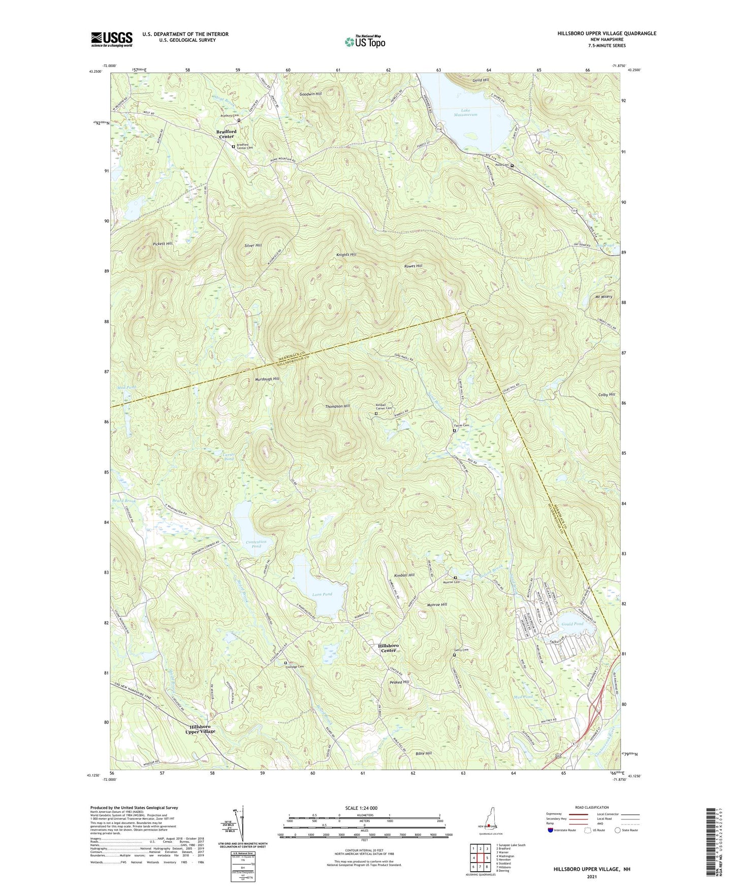
2024 topographic map quadrangle Hillsboro Upper Village in the state of New Hampshire. Scale: 1:24000. Based on the newly updated USGS 7.5' US Topo map series, this map is in the following counties: Hillsborough, Merrimack. The map contains contour data, water features, and other items you are used to seeing on USGS maps, but also has updated roads and other features. This is the next generation of topographic maps. Printed on high-quality waterproof paper with UV fade-resistant inks.
Quads adjacent to this one:
West: Washington
Northwest: Sunapee Lake South
North: Bradford
Northeast: Warner
East: Henniker
Southeast: Deering
South: Hillsboro
Southwest: Stoddard
This map covers the same area as the classic USGS quad with code o43071b8.
Contains the following named places: Black Pond Brook, Bradford Center, Bradford Center Cemetery, Bradford Congregational Church, Carter Pond, Colby Hill, Contention Pond, Coolidge Cemetery, Day Pond, Farrar Cemetery, Farrar Marsh State Wildlife Management Area, First Meeting House, Fox State Forest, Gerry Cemetery, Goodwin Hill, Gould Pond, Guild Hill, Hillsboro Camp, Hillsboro Center, Hillsboro Upper Village, Kimball Corner Cemetery, Kimball Hill, Knights Hill, Lake Franklin Pierce Dam, Lake Massasecum, Loon Pond, Monroe Hill, Mount Misery, Mud Pond, Munroe Cemetery, Murdough Hill, Nelson Brook, Peaked Hill, Pickett Hill, Pond Cemetery, Presbury Cemetery, Rowes Hill, Sand Brook, Sand Brook Marsh, Sand Brook Marsh Dam, Silver Hill, Thompson Hill, Town of Bradford, Town of Hillsborough, ZIP Code: 03244