MyTopo
Washington New Hampshire US Topo Map
Couldn't load pickup availability
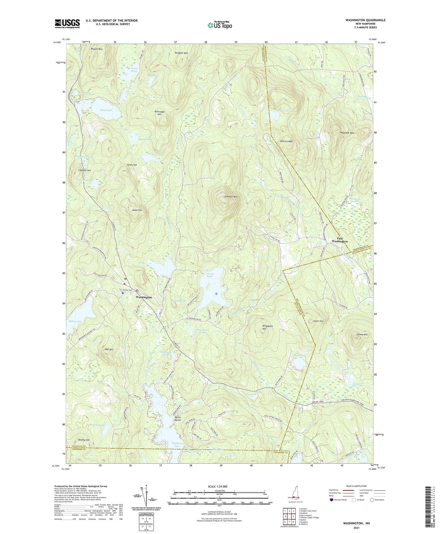
2024 topographic map quadrangle Washington in the state of New Hampshire. Scale: 1:24000. Based on the newly updated USGS 7.5' US Topo map series, this map is in the following counties: Sullivan, Merrimack, Hillsborough, Cheshire. The map contains contour data, water features, and other items you are used to seeing on USGS maps, but also has updated roads and other features. This is the next generation of topographic maps. Printed on high-quality waterproof paper with UV fade-resistant inks.
Quads adjacent to this one:
West: East Lempster
Northwest: Newport
North: Sunapee Lake South
Northeast: Bradford
East: Hillsboro Upper Village
Southeast: Hillsboro
South: Stoddard
Southwest: Marlow
This map covers the same area as the classic USGS quad with code o43072b1.
Contains the following named places: Ames Hill, Avery Ledge, Ayers Pond, Bacon Pond, Barden Pond, Barney Pond, Bear Pond, Bog Brook, Bradford Spring, Bryant Mountain, Butterfield Pond, Butterfield Pond Dam, Center Cemetery, Center School, Cherry Brook, Codman Hill, Copeland Hill, East Washington, Fletcher Pond, Freezeland Creek, Freezeland Pond, Frog Pond, Halfmoon Pond, Haystack Mountain, Healey Hill, Hedgehog Pond, Highland Lake North Outlet Dam, Island Pond, Island Pond Dam, Jones Hill, Kingsbury Hill, Kittredge Hill, Lovewell Mountain, May Pond, Millen Lake, Monadnock Sunapee Trail, Mud Pond, North Outlet, North Pond, Oak Hill, Philbruek Pond, Pillsbury State Park, Red Brook, Smith Pond, Stowe Hill, Town of Washington, Vickery Pond, Washington, Washington Common, Washington Common Historic District, Washington Congregational Church, Washington Elementary School, Washington Fire Department and Rescue Squad, Washington Meeting House, Washington Museum, Washington Police Department, Washington Post Office, White Pond Brook, Windswept Airport, Woodward Brook, ZIP Code: 03280