MyTopo
Lovering Mountain New Hampshire US Topo Map
Couldn't load pickup availability
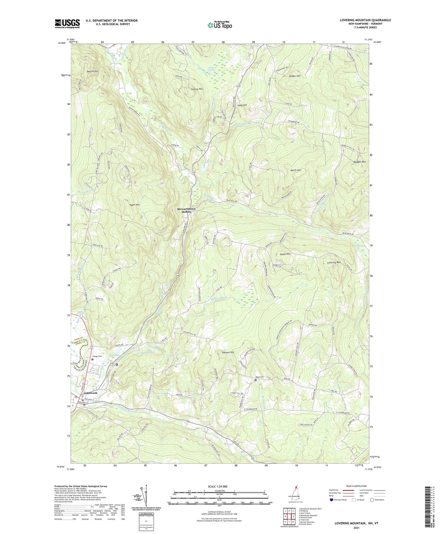
2021 topographic map quadrangle Lovering Mountain in the state of New Hampshire. Scale: 1:24000. Based on the newly updated USGS 7.5' US Topo map series, this map is in the following counties: Coos, Essex. The map contains contour data, water features, and other items you are used to seeing on USGS maps, but also has updated roads and other features. This is the next generation of topographic maps. Printed on high-quality waterproof paper with UV fade-resistant inks.
Quads adjacent to this one:
West: Monadnock Mountain
North: Pittsburg
Northeast: Lake Francis
East: Diamond Pond
Southeast: Dixville Notch
South: Bunnell Mountain
Southwest: Tinkerville
Contains the following named places: Bear Rock Bog, Bear Rock School, Beaver Brook, Beaver Brook Falls, Beaver Brook Wayside Area, Brackett School, Cedar Brook, Cedar Brook School, Clarksville Pond School, Colebrook, Colebrook Academy, Colebrook Census Designated Place, Colebrook Country Club, Colebrook Elementary School, Colebrook Fire Department, Colebrook Police Department, Colebrook Post Office, Colebrook Primary School, Collins Hill, Community Baptist School, Dearth Hill, Dyer Brook, East Colebrook Church, Factory School, Forbes School, Gulch Brook, Haines Brook, Haines School, Hurlbert Swamp, Kidder Hill, Kidderville, Ladd Pond, Lang Hill, Lombard Pond, Lovering Mountain, Matthews Pond, Mudget Mountain, North Branch Beaver Brook, North Hill, North Hill School, Numismatic International Book Library, Piper Hill, Piper Hill School, Piper School, Pond Brook, Read Brook, South Hill, South Hill School, Stevens Hill, Stewartstown Hollow, Stewartstown Hollow School, Town of Colebrook, Town of Stewartstown, Upper Connecticut Valley Hospital, Village Cemetery, Whittemore School, ZIP Code: 03576