
MyTopo
Tinkerville New Hampshire US Topo Map
Couldn't load pickup availability
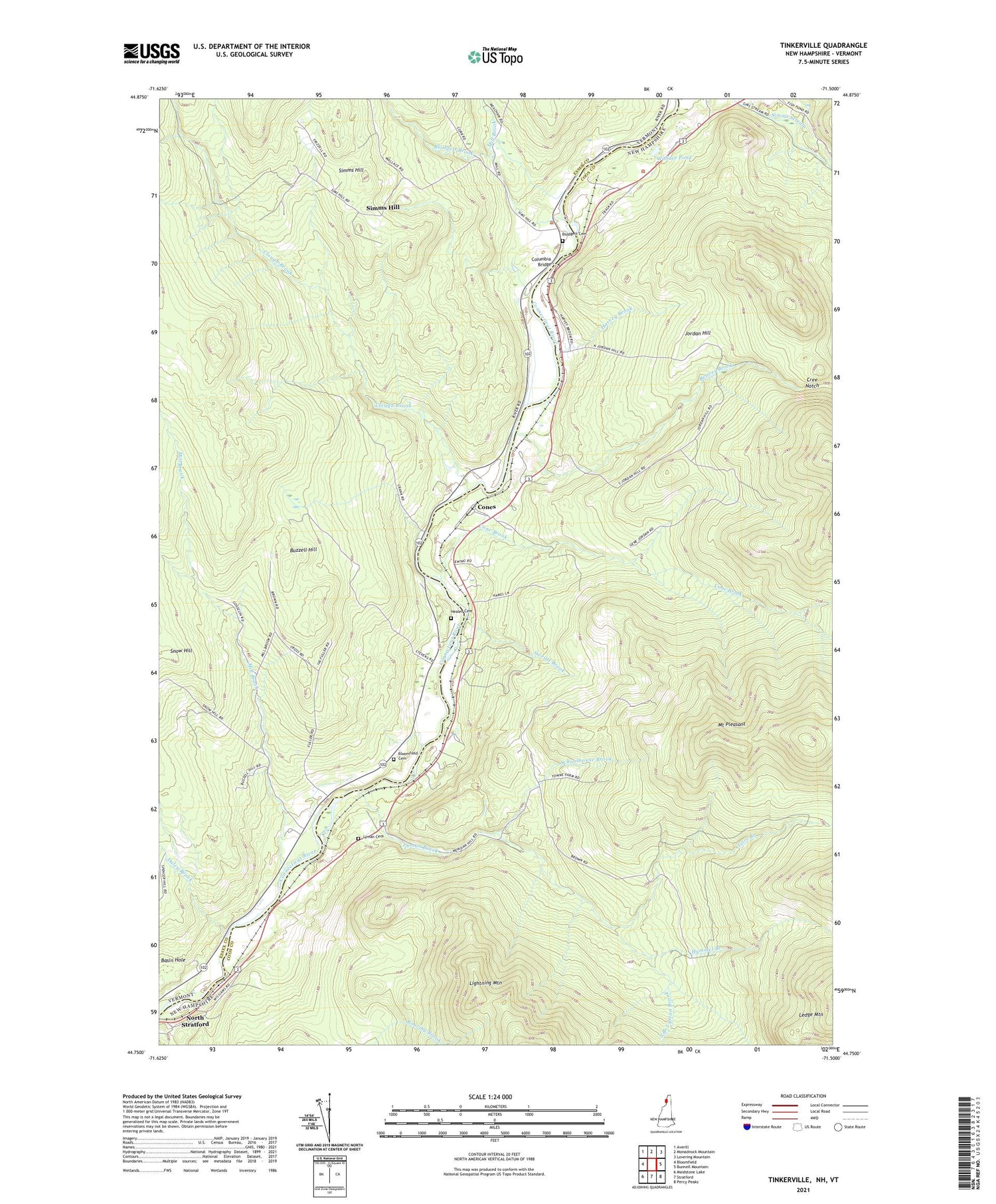
2024 topographic map quadrangle Tinkerville in the states of New Hampshire, Vermont. Scale: 1:24000. Based on the newly updated USGS 7.5' US Topo map series, this map is in the following counties: Coos, Essex. The map contains contour data, water features, and other items you are used to seeing on USGS maps, but also has updated roads and other features. This is the next generation of topographic maps. Printed on high-quality waterproof paper with UV fade-resistant inks.
Quads adjacent to this one:
West: Bloomfield
Northwest: Averill
North: Monadnock Mountain
Northeast: Lovering Mountain
East: Bunnell Mountain
Southeast: Percy Peaks
South: Stratford
Contains the following named places: Basin Hole, Beaver Brook, Blodgett Brook, Blodgett Cemetery, Bloomfield Cemetery, Buzzell Hill, Camp Number 5, Camp Number 6, Clough Brook, Columbia, Columbia Bridge, Cone Brook, Cone School, Cones, Cree Notch, Daley Brook, Georges, Gore Branch, Harvey Brook, Healey Cemetery, Hymmel Branch, Jordan Hill, Ledge Mountain, Lennington, Lightning Mountain, Lyman Brook, Lyman Cemetery, Meriden Hill, Mill Brook, Mount Pleasant, O'Neil Cemetery, Schoolhouse Brook, Simms Hill, Snow Hill, South Branch Lyman Brook, South Columbia School, Sweatt Brook, Tinkerville, Wallace Pond


