MyTopo
Lyme New Hampshire US Topo Map
Couldn't load pickup availability
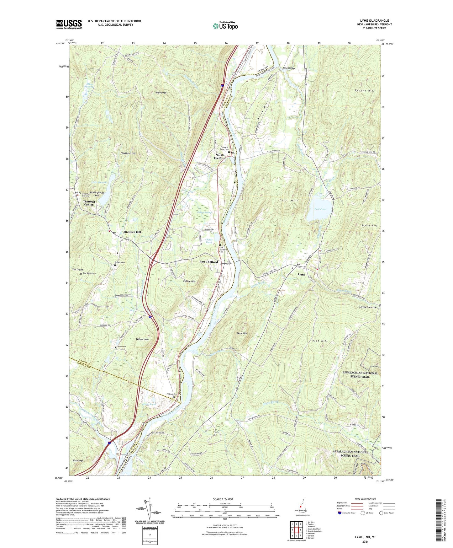
2021 topographic map quadrangle Lyme in the states of New Hampshire, Vermont. Scale: 1:24000. Based on the newly updated USGS 7.5' US Topo map series, this map is in the following counties: Grafton, Orange, Windsor. The map contains contour data, water features, and other items you are used to seeing on USGS maps, but also has updated roads and other features. This is the next generation of topographic maps. Printed on high-quality waterproof paper with UV fade-resistant inks.
Quads adjacent to this one:
West: South Strafford
Northwest: Vershire
North: Fairlee
Northeast: Piermont
East: Smarts Mountain
Southeast: Canaan
South: Enfield
Southwest: Hanover
Contains the following named places: Acorn Hill, Brick Hill, Chesley School, Childs Pond, Clay Brook, Cobble Hill, Conant Swamp, Crossroads Academy, Dartmouth Outing Club Trail, East Thetford, East Thetford Cemetery, East Thetford Post Office, Edgell Bridge, Ely School, Evergreen Rest Cemetery, Five Corners, Follett Cemetery, Gillette Swamp, Grant Brook, Gunn Brook, Hewes Brook, High Peak, Houghton Hill, Kenyon Hill, King School, Knox Cemetery, Lake Abenaki, Lake Abenaki Dam, Lewin Pond, Lyme, Lyme Center Post Office, Lyme Common Historic District, Lyme Congregational Church, Lyme Congregational Church Horse Sheds, Lyme Elementary School, Lyme First Aid Stabilization Team Squad, Lyme Hill, Lyme Post Office, Lyme Town Police Department, Lyme Volunteer Fire Department, Meetinghouse Hill, North Thetford, North Thetford Congregational Church, North Thetford Post Office, Old Congregational Church, Ompompanoosuc River, Open Fields School, Pleasant Ridge Cemetery, Plot Hill, Pompanoosuc, Pond School, Post Hill, Post Pond, Rest N'Nest Campground, Roaring Brook, Skunk Hollow, Stetson School, Stevens School, The Glebe, The Glebe Cemetery, Thetford Academy, Thetford Center, Thetford Center Post Office, Thetford Elementary School, Thetford Hill, Thetford Hill Historic District, Thetford Hill State Forest, Thetford Municipal Forest, Thetford Police Department, Thetford Post Office, Thetford Volunteer Fire Department, Town of Thetford, Trout Brook, Whipple Brook, Wilder Lake Campground, Wilder Management Area, Wilmot Cemetery, Wilmot Mountain, Zebedee Brook, ZIP Code: 05043