MyTopo
Mount Kineo New Hampshire US Topo Map
Couldn't load pickup availability
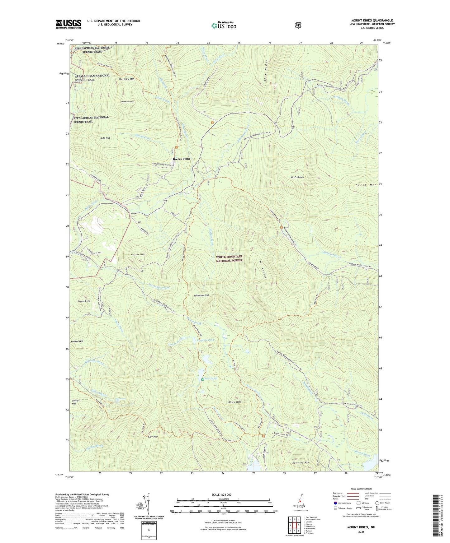
2021 topographic map quadrangle Mount Kineo in the state of New Hampshire. Scale: 1:24000. Based on the newly updated USGS 7.5' US Topo map series, this map is in the following counties: Grafton. The map contains contour data, water features, and other items you are used to seeing on USGS maps, but also has updated roads and other features. This is the next generation of topographic maps. Printed on high-quality waterproof paper with UV fade-resistant inks.
Quads adjacent to this one:
West: Warren
Northwest: East Haverhill
North: Mount Moosilauke
Northeast: Lincoln
East: Woodstock
Southeast: Plymouth
South: Rumney
Southwest: Wentworth
Contains the following named places: Bald Hill, Batchelder Brook, Big Brook, Black Hill, Blodgett Brook, Breezy Point, Buzzell Brook, Camp Number 2, Camp Number 4, Camp Number 5, Carr Mountain, Carr Mountain Trail, Chokecherry Hill, Clement Hill, Clifford Hill, Donkey Hill Cutoff, Downing Mountain, East Branch Baker River, East Warren School, Ellsworth Pond, Foxglove Pond, Gorge Brook, Grafton County, Green Mountain, Hurricane Mountain, Hurricane Trail, Jackman Brook Overlook, Jackman Camp, Little Brook, McKenney Cabin, Merrill Brook, Moosilauke Golf Club, Mount Cushman, Mount Kineo, Mount Kineo Trail, Patch Hill, Peaked Hill, Ravine Lodge, Ridge Trail, Snapper Ski Trail, Sucker Brook, Three Ponds, Three Ponds Trail, Town of Ellsworth, Waternomee Falls, Whitcher Hill, ZIP Code: 03279