MyTopo
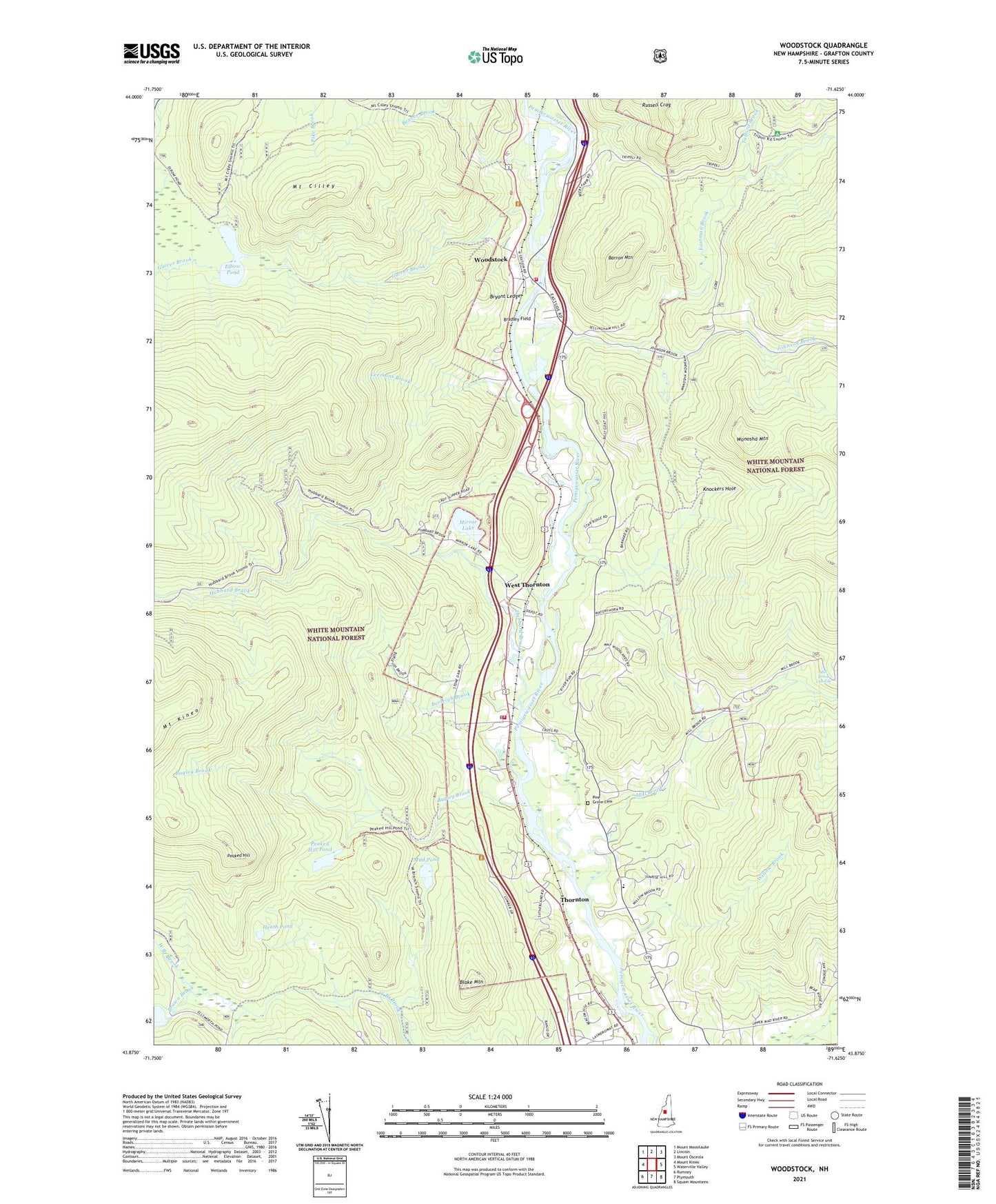
Woodstock New Hampshire US Topo Map
Couldn't load pickup availability
Also explore the Woodstock Forest Service Topo of this same quad for updated USFS data
2024 topographic map quadrangle Woodstock in the state of New Hampshire. Scale: 1:24000. Based on the newly updated USGS 7.5' US Topo map series, this map is in the following counties: Grafton. The map contains contour data, water features, and other items you are used to seeing on USGS maps, but also has updated roads and other features. This is the next generation of topographic maps. Printed on high-quality waterproof paper with UV fade-resistant inks.
Quads adjacent to this one:
West: Mount Kineo
Northwest: Mount Moosilauke
North: Lincoln
Northeast: Mount Osceola
East: Waterville Valley
Southeast: Squam Mountains
South: Plymouth
Southwest: Rumney
This map covers the same area as the classic USGS quad with code o43071h6.
Contains the following named places: Bagley Brook, Barron Mountain, Beaver Brook, Blake Mountain, Bradley Field, Brown Brook, Bryant Ledge, Burleigh Brook, Campton - Thornton Fire Department Station 2, Eastman Brook, Elbow Pond, Glover Brook, Glover Brook Trail, Heath Pond, Hubbard Brook, Hubbard Brook Trail, Jack O'Lantern Golf Course, Johnson Brook, Knockers Hole, Knockers Hole Trail, KOA Campground, Leemans Brook, Mill Brook, Mill Brook Cascade, Mirror Lake, Mirror Lake Dam, Mount Cilley, Mud Pond, Peaked Hill, Peaked Hill Pond, Peaked Hill Pond Trail, Pemi Valley Church, Pine Grove Cemetery, Russell Pond Brook, Talford Brook, Thornton, Thornton Central School, Thornton Civilian Conservation Corps Camp, Thornton Police Department, Thornton School, Thorton Church, Town of Thornton, Town of Woodstock, Wanosha Mountain, West Thornton, Willow Brook, Woodstock, Woodstock Fire Department Station 2 Lower Station, ZIP Codes: 03262, 03285, 03293