MyTopo
Mount Moosilauke New Hampshire US Topo Map
Couldn't load pickup availability
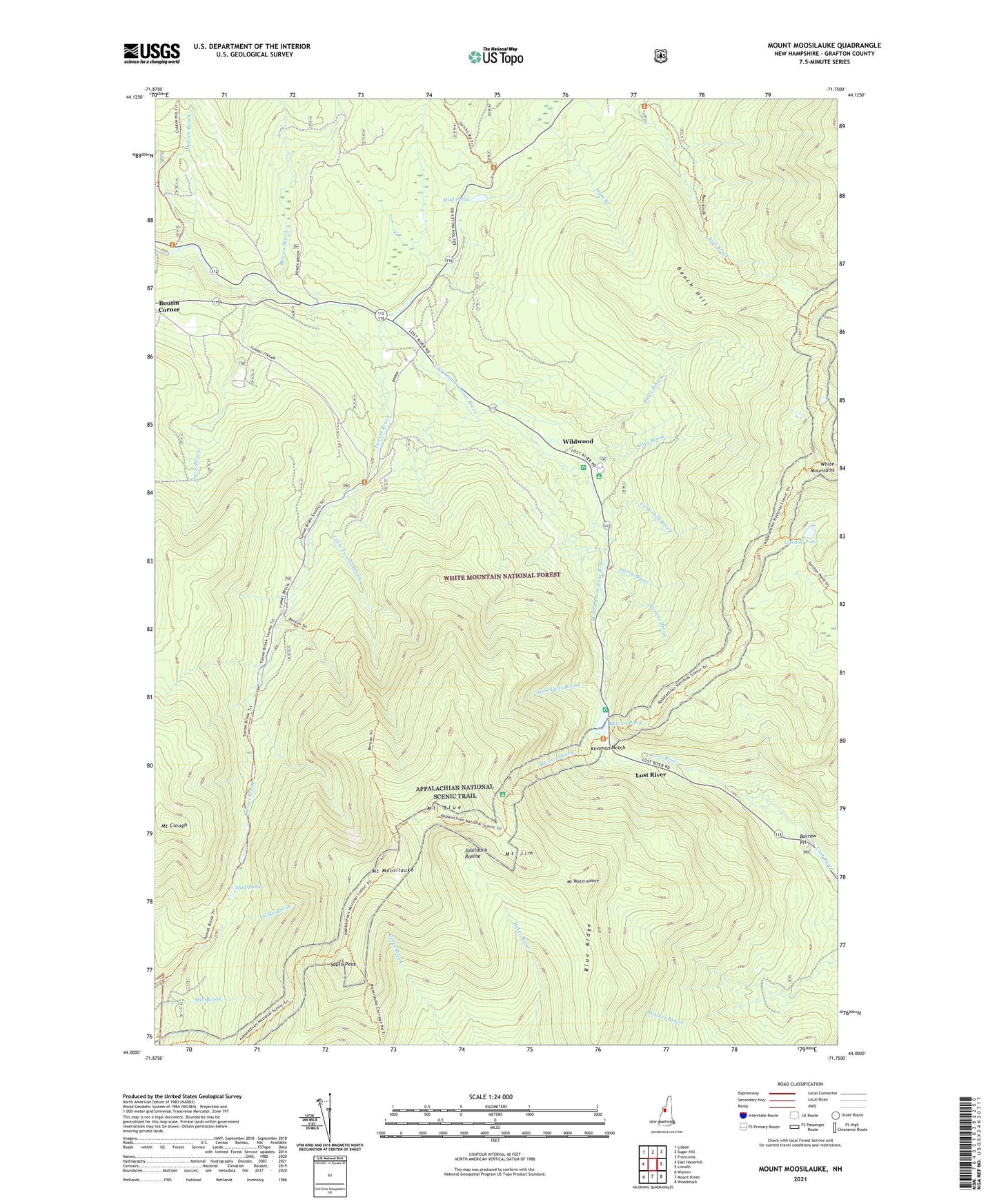
2021 topographic map quadrangle Mount Moosilauke in the state of New Hampshire. Scale: 1:24000. Based on the newly updated USGS 7.5' US Topo map series, this map is in the following counties: Grafton. The map contains contour data, water features, and other items you are used to seeing on USGS maps, but also has updated roads and other features. This is the next generation of topographic maps. Printed on high-quality waterproof paper with UV fade-resistant inks.
Quads adjacent to this one:
West: East Haverhill
Northwest: Lisbon
North: Sugar Hill
Northeast: Franconia
East: Lincoln
Southeast: Woodstock
South: Mount Kineo
Southwest: Warren
Contains the following named places: Asquamchumauke Ridge Trail, Beaver Brook, Beaver Brook Shelter DOC, Beaver Brook Trail, Beaver Pond, Beaver Pond Dam, Beech Hill, Beech Hill Trail, Benton Trail, Black Brook, Blue Ridge, Borrow Pit, Bowen Brook, Bungay Corner, Clay Brook, Davis Brook, Dearth Brook, Glencliff Trail, Gordon Pond, Gorge Brook Trail, Jobildunk Ravine, Kinsman Notch, Kinsman Notch Nature Area, Little Tunnel Brook, Lost River, Moosilauke Carriage Road, Mount Blue, Mount Clough, Mount Jim, Mount Moosilauke, Mount Waternomee, Mount Wolf, Mud Pond, Olesons Brook, Reel Brook Trail, Ridge Trail, South Peak, Stark Falls Brook, Stony Brook, Tunnel Brook, Tunnel Brook Trail, Underhill Brook, Wildwood, Wildwood Campground and Picnic Area, Wildwood Civilian Conservation Corps Campground, Wildwood Forest Camp