MyTopo
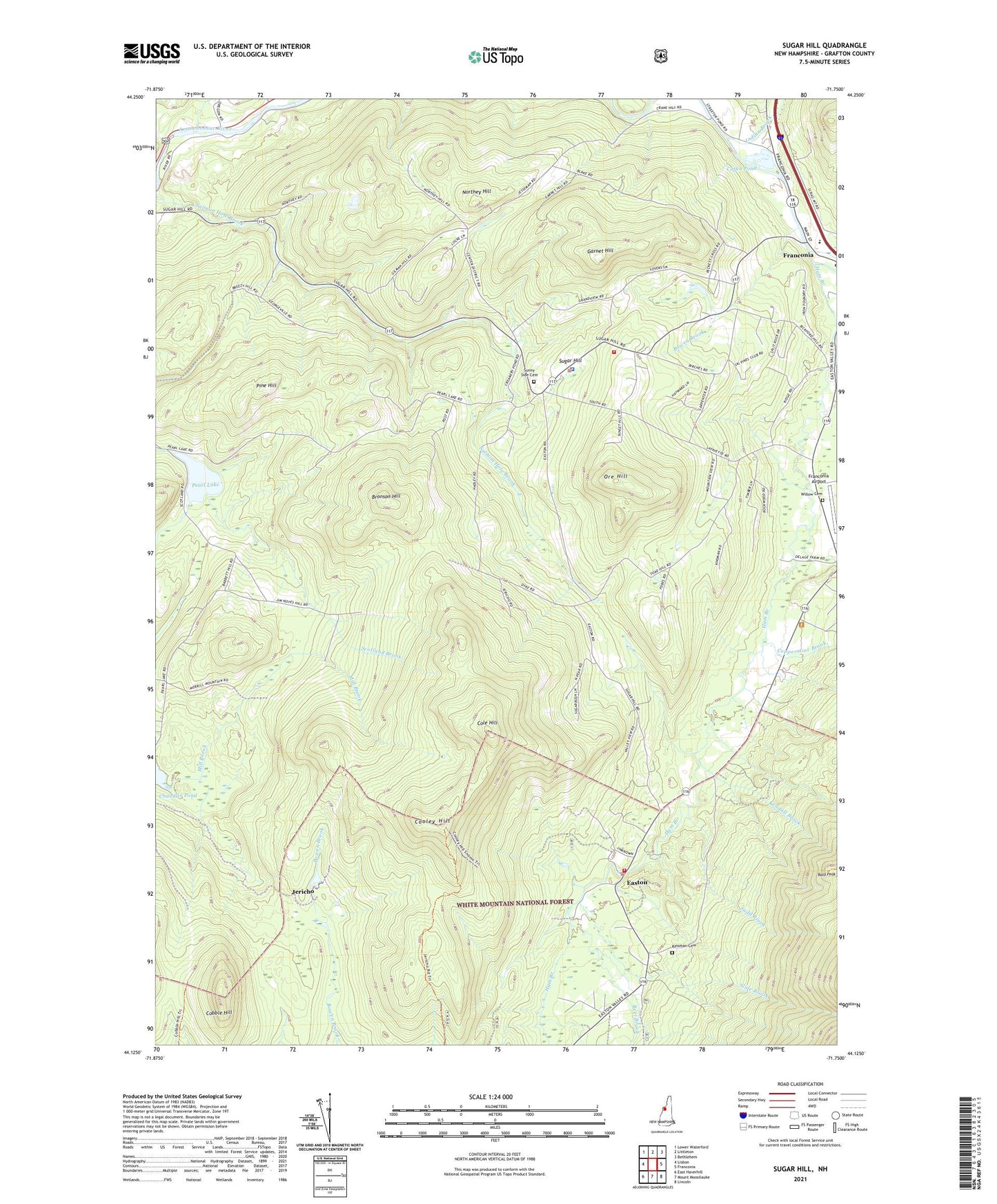
Sugar Hill New Hampshire US Topo Map
Couldn't load pickup availability
Also explore the Sugar Hill Forest Service Topo of this same quad for updated USFS data
2024 topographic map quadrangle Sugar Hill in the state of New Hampshire. Scale: 1:24000. Based on the newly updated USGS 7.5' US Topo map series, this map is in the following counties: Grafton. The map contains contour data, water features, and other items you are used to seeing on USGS maps, but also has updated roads and other features. This is the next generation of topographic maps. Printed on high-quality waterproof paper with UV fade-resistant inks.
Quads adjacent to this one:
West: Lisbon
North: Littleton
Northeast: Bethlehem
East: Franconia
Southeast: Lincoln
South: Mount Moosilauke
Southwest: East Haverhill
This map covers the same area as the classic USGS quad with code o44071b7.
Contains the following named places: Bald Peak, Bowen Brook, Bronson Hill, Chandler Pond Dam, Cobble Hill, Cobble Hill Trail, Coffin Pond, Coffin Pond Dam, Cole Hill, Community Church, Cooley Hill, Coppermine Brook, Easton, Easton Volunteer Fire Department, Franconia Airport, Garnet Hill, Ham Branch, Indian Brook, Jericho, Jericho Road Trail, Judd Brook, Kendall Brook, Kinsman Cemetery, Lafayette Regional School, Northey Hill, Ore Hill, Pearl Lake, Pearl Lake Dam, Pine Hill, Pond Hill, Reel Brook, Robert From Museum, Saint Matthews Church, School Number 2, School Number 3, Scotland Brook, Scotland School, Slide Brook, Sugar Hill, Sugar Hill Fire Department, Sugar Hill Police Dept, Sunny Side Cemetery, Sunset Hill House Ski Touring Center, Town of Easton, Town of Lisbon, Town of Sugar Hill, Whipple Brook, Willow Cemetery, ZIP Code: 03586