MyTopo
East Corinth Vermont US Topo Map
Couldn't load pickup availability
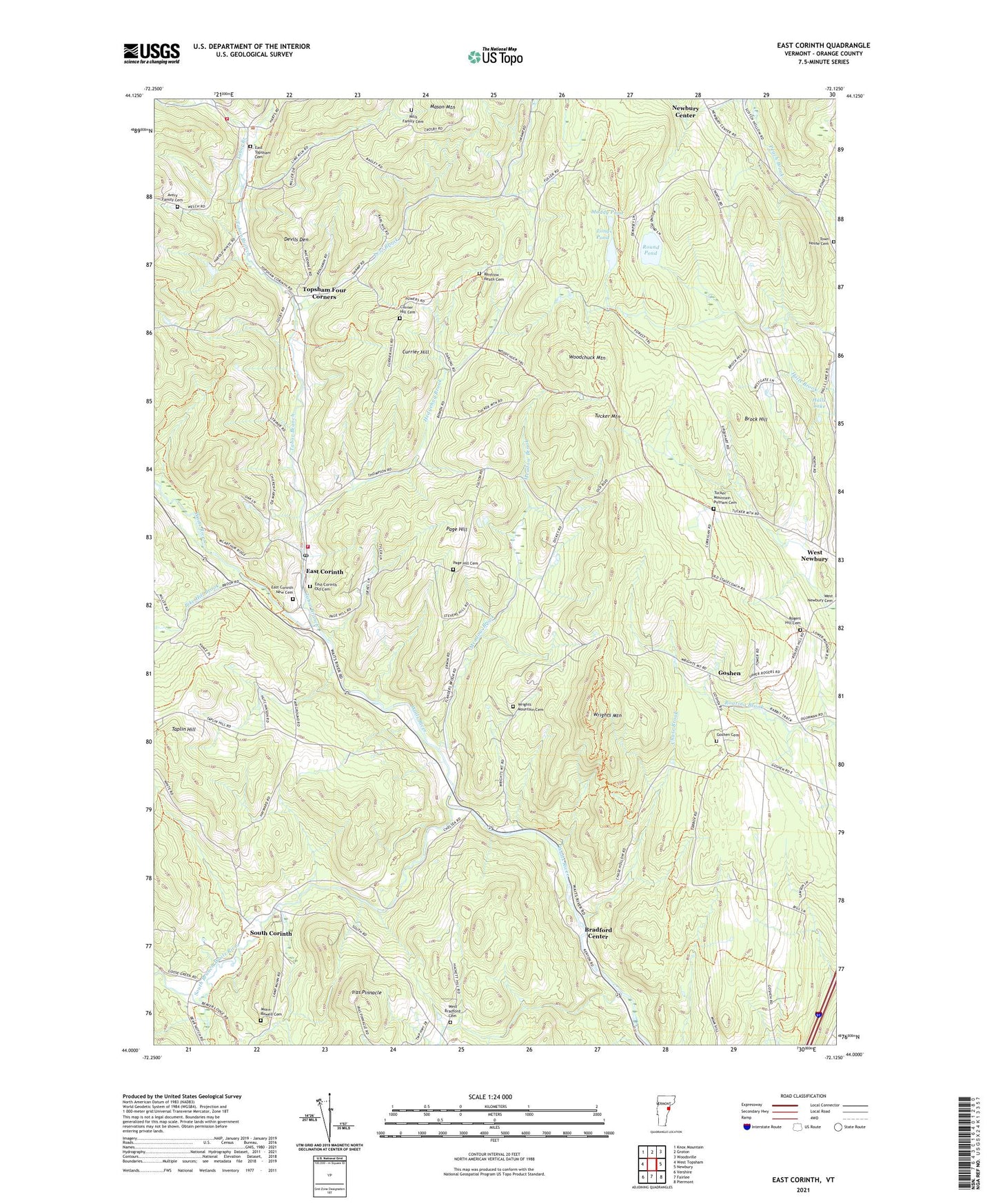
2024 topographic map quadrangle East Corinth in the state of Vermont. Scale: 1:24000. Based on the newly updated USGS 7.5' US Topo map series, this map is in the following counties: Orange. The map contains contour data, water features, and other items you are used to seeing on USGS maps, but also has updated roads and other features. This is the next generation of topographic maps. Printed on high-quality waterproof paper with UV fade-resistant inks.
Quads adjacent to this one:
West: West Topsham
Northwest: Knox Mountain
North: Groton
Northeast: Woodsville
Southeast: Piermont
South: Fairlee
Southwest: Vershire
This map covers the same area as the classic USGS quad with code o44072a2.
Contains the following named places: Avery Family Cemetery, Blake Memorial Library, Bradford Center, Brock Hill, Brock Hill School, Chase Brook, Currier Hill, Currier Hill Cemetery, Devils Den, East Corinth, East Corinth New Cemetery, East Corinth Old Cemetery, East Corinth Post Office, East Corinth Volunteer Fire Department, East Topsham, East Topsham Cemetery, Goshen, Goshen Cemetery, Goshen Church, Goshen School, Halls Lake, Halls Lake Dam, Hedgehog Brook, Iras Pinnacle, Levi Brook, Long Pond, Meadow Brook, Mills Family Cemetery, Muddy Pond, Munn-Rowell Cemetery, Newbury Center, Page Hill, Page Hill Cemetery, Pike Hill Brook, Renfrow - Heath Cemetery, Rogers Hill Cemetery, Round Pond, South Branch Waits River, South Corinth, South Corinth School, Tabor Branch, Taplin Hill, Taplin Hill School, Topsham Four Corners, Town House Cemetery, Town of Bradford, Tri - Village Fire Department, Tucker Mountain, Tucker Mountain - Putnam Cemetery, West Bradford Cemetery, West Bradford School, West Newbury Village Historic District, Woodchuck Mountain, Wrights Mountain, Wrights Mountain Cemetery, Wrights Mountain Trail, ZIP Codes: 05033, 05040