MyTopo
Plymouth New Hampshire US Topo Map
Couldn't load pickup availability
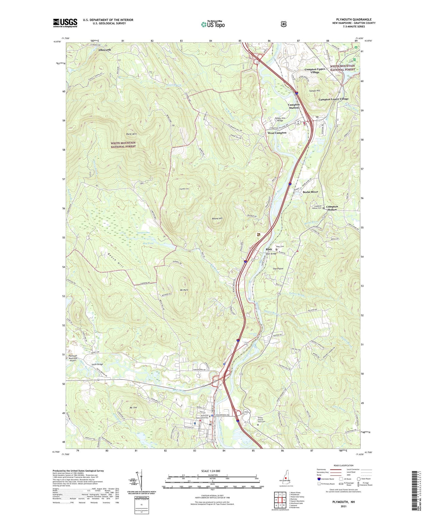
2021 topographic map quadrangle Plymouth in the state of New Hampshire. Scale: 1:24000. Based on the newly updated USGS 7.5' US Topo map series, this map is in the following counties: Grafton. The map contains contour data, water features, and other items you are used to seeing on USGS maps, but also has updated roads and other features. This is the next generation of topographic maps. Printed on high-quality waterproof paper with UV fade-resistant inks.
Quads adjacent to this one:
West: Rumney
Northwest: Mount Kineo
North: Woodstock
Northeast: Waterville Valley
East: Squam Mountains
Southeast: Holderness
South: Ashland
Southwest: Newfound Lake
Contains the following named places: Avery Brook, Baker River, Baker River School, Bald Mountain, Beebe River, Beebe River Railroad Station, Beech Hill, Blair, Blair Bridge, Blair Cemetery, Blair School, Bog Brook, Bog Pond, Bog School, Calvary Christian School, Campton - Thornton Fire Department Station 1 Headquarters, Campton - Thornton Fire Department Station 3, Campton Bog, Campton Bog Pond Dam, Campton Church, Campton Elementary School, Campton Hollow, Campton Hollow Cemetery, Campton Lower Village, Campton Police Department, Campton Pond, Campton Pond Dam, Campton Pond Forest Camp, Campton Post Office, Campton Recreation Area, Campton Station, Campton Upper Village, Chandler Hill, Clay Brook, Durgin Brook, Ellsworth, Elm School, Fox Pond, Fox Pond Dam, Great Brook, Holderness School, Livermore Falls, Livermore School, Lyfords Siding, Mad River, Maple Cottage School, Milo Lake, Milo Lake Dam, Mount Pero, Mount Prospect Academy, Mount Tim, Old Grafton County Courthouse, Palmer Brook, Pease Public Library, Pemigewasset District Ranger Station, Plymouth, Plymouth Congregational Church, Plymouth Elementary Preschool, Plymouth Elementary School, Plymouth Fire Rescue Department, Plymouth Historic District, Plymouth Police Department, Plymouth Post Office, Plymouth Regional High School, Plymouth State Fairgrounds, Plymouth State University, Plymouth State University Police Department, Plymouth Town Common, Plymouth Town Hall, Pulsifer Hill School, Round Hill, Rowbartwood Marsh Wildlife Management Area, Smith Bridge, Speare Memorial Hospital, Sunset Hill, The Hatch Plaza Shopping Center, The Plains, Town of Campton, Trinity Church, Trinity Church Yard Cemetery, Turkey Jims Bridge, West Branch Brook, West Campton, Winter Brook, WPCR-FM (Plymouth), WPNH-AM (Plymouth), WPNH-FM (Plymouth), ZIP Code: 03223