MyTopo
Twin Mountain New Hampshire US Topo Map
Couldn't load pickup availability
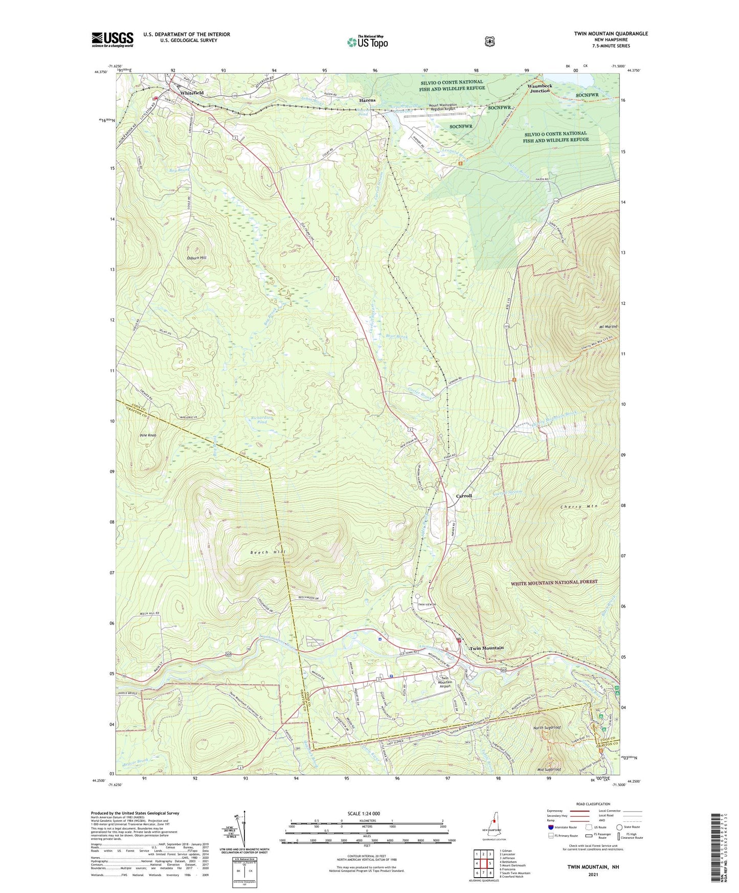
2021 topographic map quadrangle Twin Mountain in the state of New Hampshire. Scale: 1:24000. Based on the newly updated USGS 7.5' US Topo map series, this map is in the following counties: Coos, Grafton. The map contains contour data, water features, and other items you are used to seeing on USGS maps, but also has updated roads and other features. This is the next generation of topographic maps. Printed on high-quality waterproof paper with UV fade-resistant inks.
Quads adjacent to this one:
West: Bethlehem
Northwest: Gilman
North: Lancaster
Northeast: Jefferson
East: Mount Dartmouth
Southeast: Crawford Notch
South: South Twin Mountain
Southwest: Franconia
Contains the following named places: Airport Marsh Dam, Airport Marsh Reservoir, Alder Brook, Ayling Brook, Baby Twin Trail, Beach Hill Campground and Cabins, Bear Brook, Beech Hill, Black Brook, Black Brook Trail, Bog Brook, Carroll, Carroll Police Department, Carroll Station, Carroll Stream, Carter Brook, Cherry Mountain Brook, Community Baptist Church, Gale River Civilian Conservation Corps Camp, Haystack Brook, Hazens, Hazens Pond, Leonard Brook, Little River, Middle Sugarloaf, Mount Washington Regional Airport, New Hampshire State Police Troop F, North Sugarloaf, Nubble Mountain Trail, Osburn Hill, Osburn School, Pine Grove School, Pine Knob, Quebec Junction, Richardson Pond, Saint Patricks Roman Catholic Church, Sugarloaf Campground, Town of Bethlehem, Town of Carroll, Town of Whitefield, Turtle Brook Trail, Tuttle Brook, Twin Mountain, Twin Mountain Airport, Twin Mountain Ambulance Service, Twin Mountain Baptist Church, Twin Mountain Christian Academy, Twin Mountain Fire Department, Twin Mountain Fish Hatchery, Twin Mountain Post Office, Twin Mountain Wildlife Center, Waumbeck Junction, Whitefield, Whitefield Ambulance Service, Whitefield Census Designated Place, Whitefield Elementary School, Whitefield Family Health Clinic, Whitefield Fire Rescue Department, Whitefield Police Department, Whitefield Post Office, Whitefield Regional Airport, Zealand River, ZIP Code: 03574