MyTopo
Bethlehem New Hampshire US Topo Map
Couldn't load pickup availability
Also explore the Bethlehem Forest Service Topo of this same quad for updated USFS data
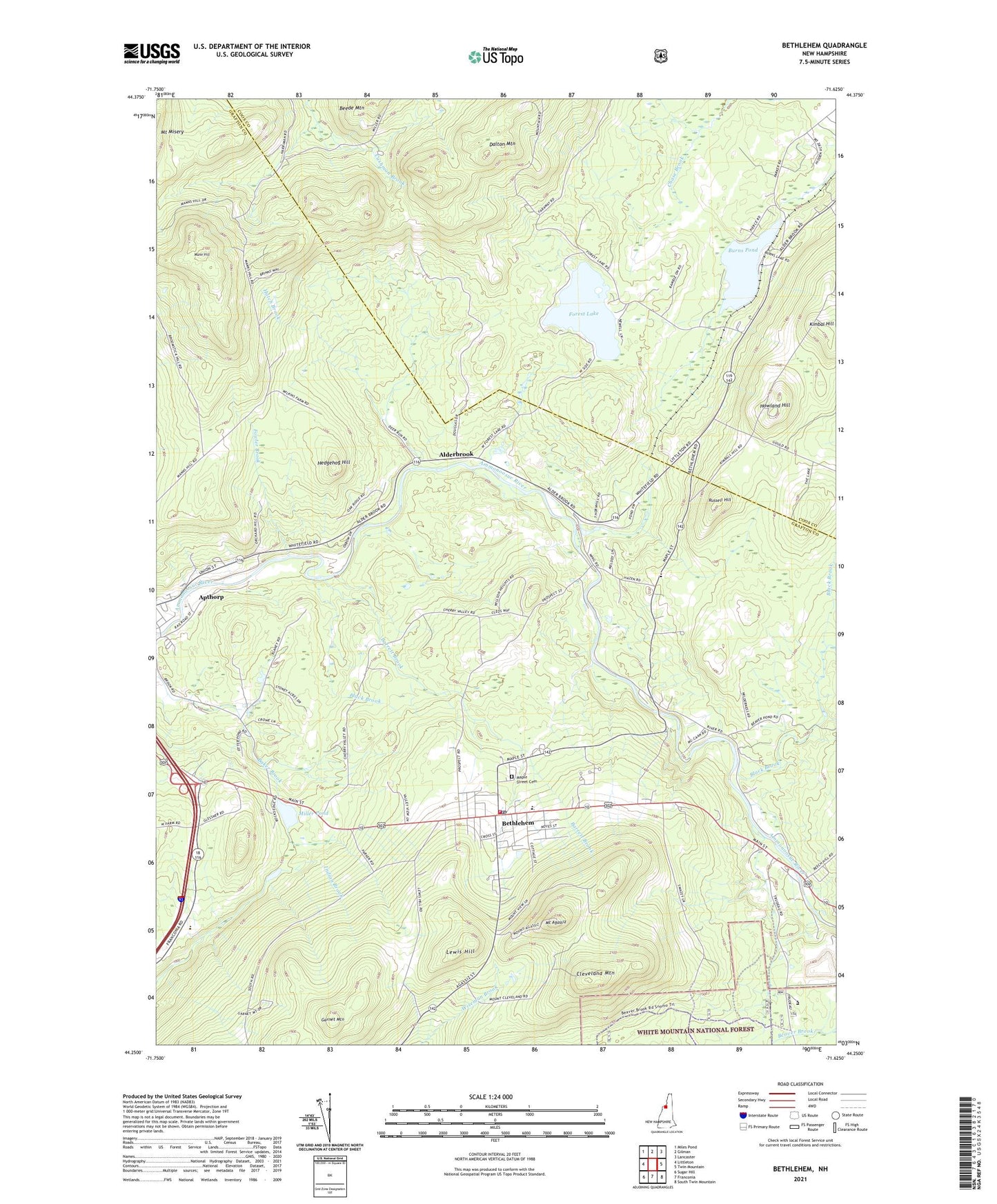
2024 topographic map quadrangle Bethlehem in the state of New Hampshire. Scale: 1:24000. Based on the newly updated USGS 7.5' US Topo map series, this map is in the following counties: Grafton, Coos. The map contains contour data, water features, and other items you are used to seeing on USGS maps, but also has updated roads and other features. This is the next generation of topographic maps. Printed on high-quality waterproof paper with UV fade-resistant inks.
Quads adjacent to this one:
West: Littleton
Northwest: Miles Pond
North: Gilman
Northeast: Lancaster
East: Twin Mountain
Southeast: South Twin Mountain
South: Franconia
Southwest: Sugar Hill
This map covers the same area as the classic USGS quad with code o44071c6.
Contains the following named places: Alderbrook, Ammonoosucuc River Reservoir, Apple Hill Campground, Apthorp, Apthorp Common, Apthorp Dam, Barrett Brook, Bethlehem, Bethlehem Census Designated Place, Bethlehem Christian Center, Bethlehem Country Club, Bethlehem Dam, Bethlehem Elementary School, Bethlehem Fire Department, Bethlehem Hebrew Congregation, Bethlehem Police Department, Bethlehem Post Office, Bethlehem Town Hall, Black Brook, Burn Lake Dam, Burns Pond, Christ the King Roman Catholic Church, Cleveland Mountain, Durrell Memorial United Methodist Church, Forest Lake, Forest Lake Dam, Forest Lake State Park, Fowler Brook, Garnet Mountain, Hatch Brook, Hedgehog Hill, Howland Hill, Ivie Memorial Church of the Messiah Episcopal Church, Kimbal Hill, Lewis Hill, Mann Hill, Maple Street Cemetery, Maplewood, Miller Pond, Miller Pond Dam, Mount Agassiz, Newtons Mobile Park, Pierce Bridge, Profile Junior and Senior High School, Russell Hill, Wing Road, WLED-TV (Littleton), WMTK-FM (Littleton), Woodland Community School