MyTopo
Brigantine Inlet New Jersey US Topo Map
Couldn't load pickup availability
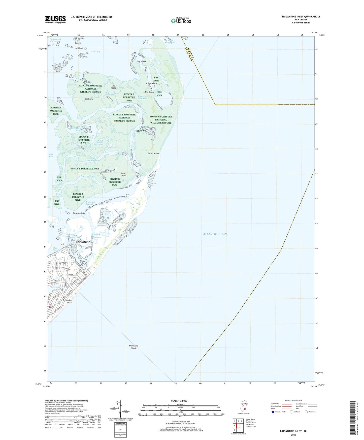
2023 topographic map quadrangle Brigantine Inlet in the state of New Jersey. Scale: 1:24000. Based on the newly updated USGS 7.5' US Topo map series, this map is in the following counties: Atlantic, Ocean. The map contains contour data, water features, and other items you are used to seeing on USGS maps, but also has updated roads and other features. This is the next generation of topographic maps. Printed on high-quality waterproof paper with UV fade-resistant inks.
Quads adjacent to this one:
West: Oceanville
Northwest: New Gretna
North: Tuckerton
Northeast: Beach Haven
Southwest: Atlantic City
This map covers the same area as the classic USGS quad with code o39074d3.
Contains the following named places: Baremore Quarters, Betsey Channel, Brigantine, Brigantine Beach Patrol, Brigantine Central School, Brigantine Channel, Brigantine City Hall, Brigantine Country Club, Brigantine Fire Department, Brigantine Inlet, Brigantine North School, Brigantine Police Department, Brigantine Shoal, Cabbage Thorofare, Dog Island, Egg Island, Elder Island, Fourteenth Street Pier, Great Thorofare, Hoffman Point, Hoffman Thorofare, Island Beach, Little Beach, Little Crooked Thorofare, Little Egg Inlet, Little Mud Thorofare, Little Weakfish Thorofare, Mile Thorofare, Mud Thorofare, Pullen Island, Salt Island, Simkins Thorofare, Somers Bay, Steelman Bay, Weakfish Thorofare, Widgeon Bay