MyTopo
Pemberton New Jersey US Topo Map
Couldn't load pickup availability
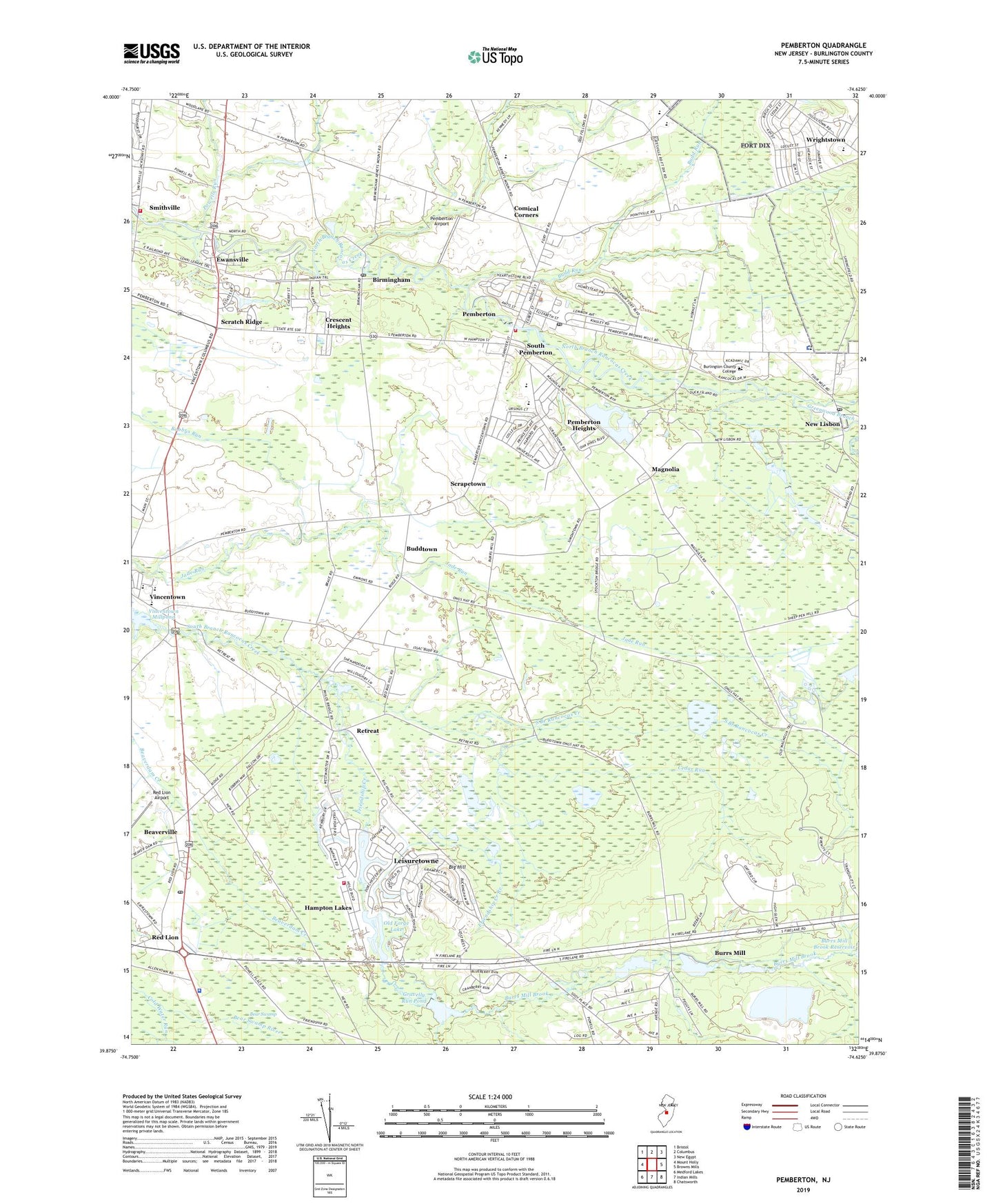
2023 topographic map quadrangle Pemberton in the state of New Jersey. Scale: 1:24000. Based on the newly updated USGS 7.5' US Topo map series, this map is in the following counties: Burlington. The map contains contour data, water features, and other items you are used to seeing on USGS maps, but also has updated roads and other features. This is the next generation of topographic maps. Printed on high-quality waterproof paper with UV fade-resistant inks.
Quads adjacent to this one:
West: Mount Holly
Northwest: Bristol
North: Columbus
Northeast: New Egypt
East: Browns Mills
Southeast: Chatsworth
South: Indian Mills
Southwest: Medford Lakes
This map covers the same area as the classic USGS quad with code o39074h6.
Contains the following named places: Beaverdam Creek, Beaverville, Big Hill, Birmingham, Birmingham Post Office, Borough of Pemberton, Budd Run, Buddtown, Burlington County, Burlington County Alternative High School, Burlington County College, Burlington County Juvenile Detention Center, Burrs Mill, Burrs Mill Brook, Buttonwood Hospital of Burlington County, Cedar Run, Cold Water Run, Comical Corners, Crescent Heights, Eastampton Township Fire Company Station 341, Ewansville, Fort Dix Elementary School, Friendship Creek, Friendship Creek Branch, Good Will Fire Company, Gravelly Run Dam, Gravelly Run Pond, Greenwood Branch, Hampton Lakes, Hampton Lakes Emergency Squad, Hampton Lakes Fire Company, Helen A Fort Middle School, Howard L Emmons Elementary School, Huntington Drive Dam, Lake Three, Leisuretowne, Leisuretowne Census Designated Place, Lisbon Dam, Magnolia, Magnolia Road Volunteer Fire Company, Marcus W Newcomb Middle School, Marl Pit, New Jersey State Police Troop C Red Lion Station, New Lisbon, New Lisbon Mill Dam, New Lisbon Post Office, Oak Grove Church, Old Forge Lake, Pemberton, Pemberton Airport, Pemberton Borough Elementary School, Pemberton Borough Police Department, Pemberton First Aid and Rescue Squad, Pemberton Heights, Pemberton Heights Census Designated Place, Pemberton Post Office, Pemberton Township High School, Pemberton Township Police Department, Powells Run, Red Lion, Red Lion Airport, Red Lion Circle, Retreat, Saint James Church, Samuel T Busansky Elementary School, Scrapetown, Scratch Ridge, Smithville, South Pemberton, Southampton Township School Number 1, Southampton Township School Number 2, Southampton Township School Number 3, Township of Southampton, Vincentown, Vincentown Millpond, Vincentown Post Office, WWJZ-AM (Mount Holly), ZIP Codes: 08011, 08064, 08068