MyTopo
Columbus New Jersey US Topo Map
Couldn't load pickup availability
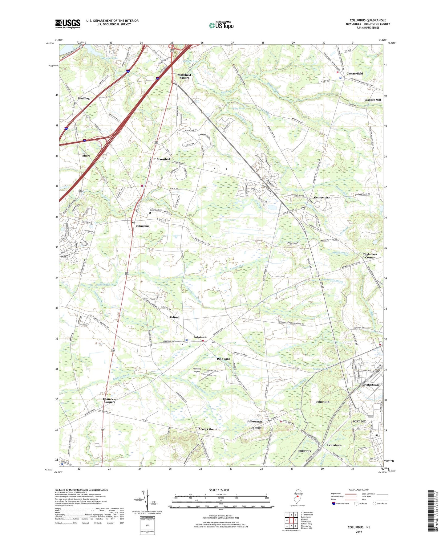
2023 topographic map quadrangle Columbus in the state of New Jersey. Scale: 1:24000. Based on the newly updated USGS 7.5' US Topo map series, this map is in the following counties: Burlington. The map contains contour data, water features, and other items you are used to seeing on USGS maps, but also has updated roads and other features. This is the next generation of topographic maps. Printed on high-quality waterproof paper with UV fade-resistant inks.
Quads adjacent to this one:
West: Bristol
Northwest: Trenton West
North: Trenton East
Northeast: Allentown
East: New Egypt
Southeast: Browns Mills
South: Pemberton
Southwest: Mount Holly
This map covers the same area as the classic USGS quad with code o40074a6.
Contains the following named places: Annaricken Brook, Arneys Mount, Assiscunk Branch, Bacons Run, Borough of Wrightstown, Carslake Pond, Chambers Corners, Chesterfield, Chesterfield Elementary School, Chesterfield Emergency Squad, Chesterfield Hose Company Station 262, Chesterfield Township Police Department, Colliers Pond, Columbus, Columbus Cemetery, Columbus Civic and Athletic Club, Columbus Post Office, Crystal Lake, Eastampton Emergency Squad, Eastampton Township Police Department, Fern Brook, Folwell, Fort Dix Post Office, Franklin Fire Company, Georgetown, Hampton Behavioral Health Center, Hedding, Jobstown, Jobstown Census Designated Place, Jobstown Post Office, John Hydock Elementary School, Juliustown, Juliustown Census Designated Place, Juliustown Post Office, Juliustown Volunteer Fire Company, Kuser Pond, Lewistown, Mansfield, Mansfield Ambulance, Mansfield Square, Mansfield Township Elementary School, Mansfield Township Police Department, Mount Holly Speedway, Mount Pisgah, Northern Burlington County Regional High School, Northern Burlington County Regional Middle School, Pine Lane, Redwing Airport, Saint Andrews Church, Saylors Pond, Sharp, Springfield, Springfield Township Elementary School, Springfield Township Emergency Medical Services, Springfield Township Fire Company, Springfield Township Police Department, State of New Jersey, Tilghmans Corner, Township of Chesterfield, Township of Mansfield, Township of Springfield, Wallace Mill, Wallace Mill Dam, Wallace Mill Pond, Wrightstown Volunteer Fire Company 1, ZIP Codes: 08022, 08041, 08042, 08505, 08515