MyTopo
Chatsworth New Jersey US Topo Map
Couldn't load pickup availability
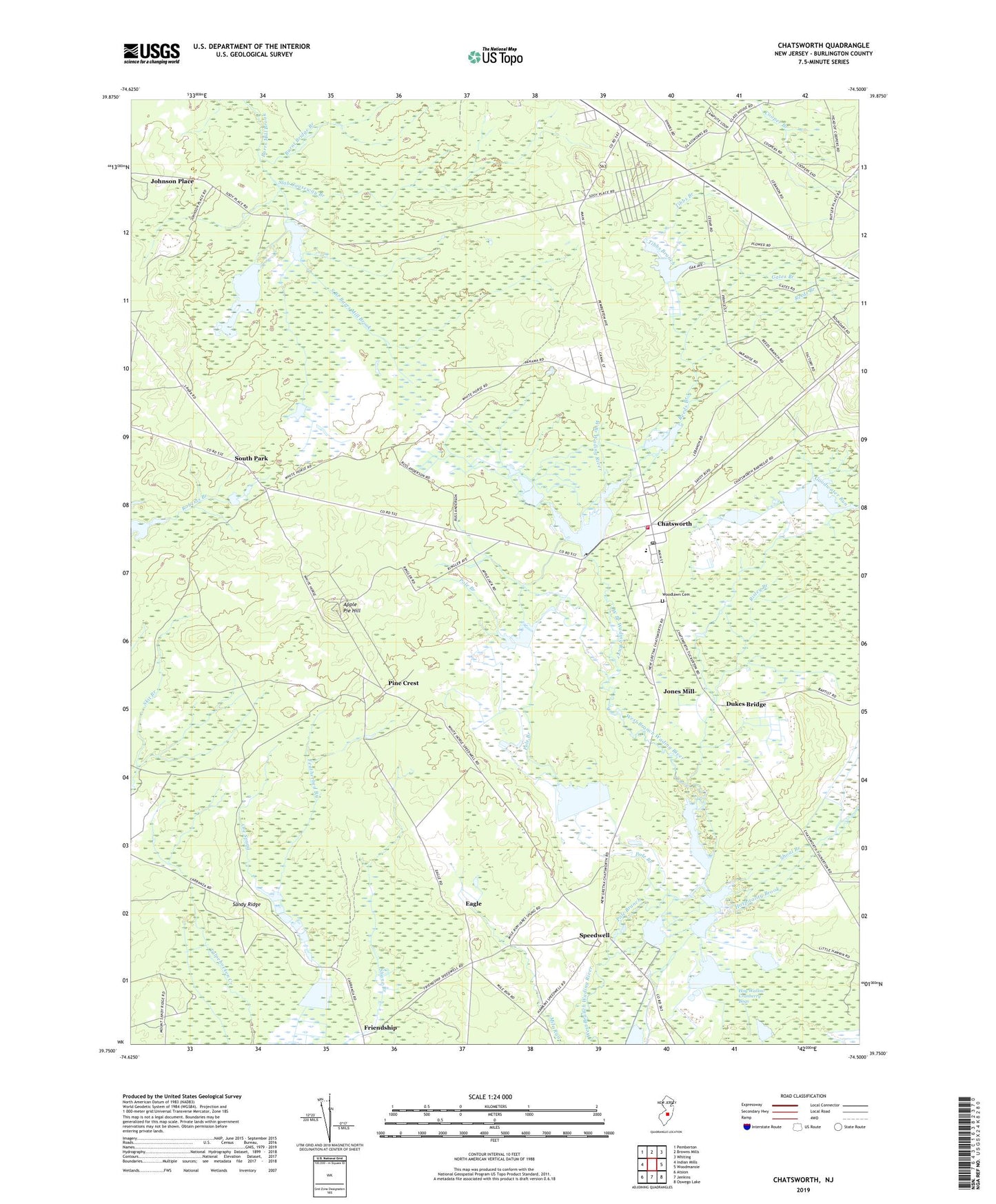
2019 topographic map quadrangle Chatsworth in the state of New Jersey. Scale: 1:24000. Based on the newly updated USGS 7.5' US Topo map series, this map is in the following counties: Burlington. The map contains contour data, water features, and other items you are used to seeing on USGS maps, but also has updated roads and other features. This is the next generation of topographic maps. Printed on high-quality waterproof paper with UV fade-resistant inks.
Quads adjacent to this one:
West: Indian Mills
Northwest: Pemberton
North: Browns Mills
Northeast: Whiting
East: Woodmansie
Southeast: Oswego Lake
South: Jenkins
Southwest: Atsion
Contains the following named places: Apple Pie Hill, Apple Pie Hill Forestry Lookout Tower, Burlington County Department of Public Safety Communications Tower, Burnt Bridge Branch, Butlers Place, Chatsworth, Chatsworth Elementary School, Chatsworth Lake, Chatsworth Lake Dam, Chatsworth Methodist Church, Chatsworth Post Office, Chatsworth Volunteer Fire Company 1, Chatsworth Woods, Comcast Communications Tower, Dukes Bridge, Eagle, Friendship, Gates Branch, Gum Spring, Hedger House, Johnson Place, Jones Mill, New Jersey Forest Fire Service B3, Ore Spung, Pine Crest, Pole Branch, Reeds Branch, Risley Branch, Sandy Ridge, Shane Branch, Shoal Branch, Slab Causeway Branch, South Branch Burrs Mill Brook, South Park, Speedwell, Tibbs Branch, Township of Woodland, Woodland Township Municipal Building, Woodlawn Cemetery, ZIP Code: 08019