MyTopo
Jenkins New Jersey US Topo Map
Couldn't load pickup availability
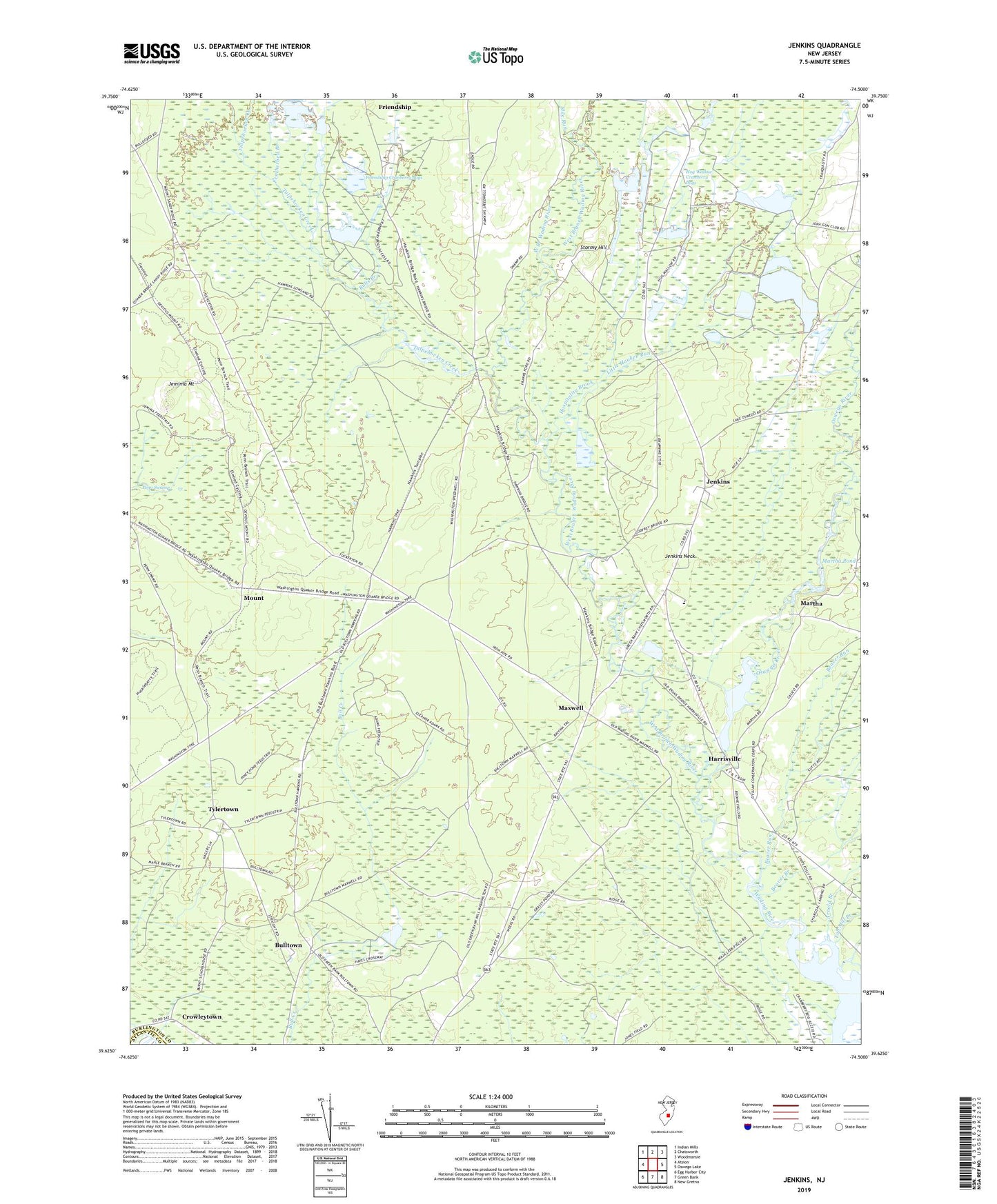
2023 topographic map quadrangle Jenkins in the state of New Jersey. Scale: 1:24000. Based on the newly updated USGS 7.5' US Topo map series, this map is in the following counties: Burlington, Atlantic. The map contains contour data, water features, and other items you are used to seeing on USGS maps, but also has updated roads and other features. This is the next generation of topographic maps. Printed on high-quality waterproof paper with UV fade-resistant inks.
Quads adjacent to this one:
West: Atsion
Northwest: Indian Mills
North: Chatsworth
Northeast: Woodmansie
East: Oswego Lake
Southeast: New Gretna
South: Green Bank
Southwest: Egg Harbor City
This map covers the same area as the classic USGS quad with code o39074f5.
Contains the following named places: Arnold Branch, Beaver Branch, Beaver Run, Buck Run, Bulls Branch, Bulltown, Charcoal Landing, Crowleytown, Featherbed Branch, Friendship Cranberry Bogs, Harrisville, Harrisville Dam, Harrisville Pond, Hog Wallow Cranberry Bogs, Hospitality Brook, Jemima Mount, Jenkins, Jenkins Chapel, Jenkins Neck, Little Hauken Run, Martha, Martha Pond, Maxwell, Mile Run, Mount, Oswego River, Stormy Hill, Township of Washington, Tub Mill Branch, Tulpehocken Creek, Tylertown, Washington, West Branch Wading River