MyTopo
Atsion New Jersey US Topo Map
Couldn't load pickup availability
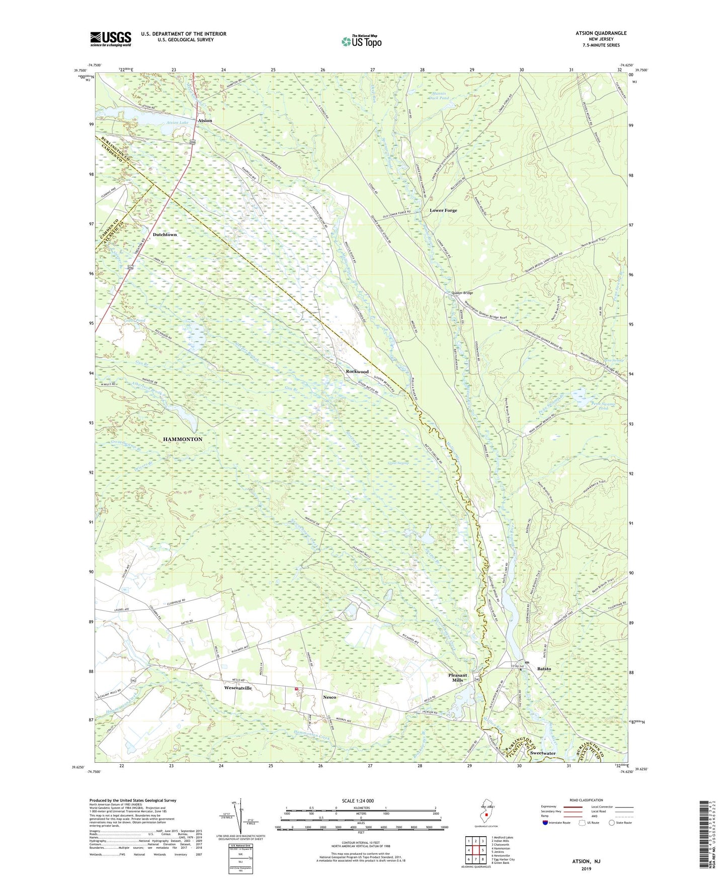
2023 topographic map quadrangle Atsion in the state of New Jersey. Scale: 1:24000. Based on the newly updated USGS 7.5' US Topo map series, this map is in the following counties: Burlington, Atlantic, Camden. The map contains contour data, water features, and other items you are used to seeing on USGS maps, but also has updated roads and other features. This is the next generation of topographic maps. Printed on high-quality waterproof paper with UV fade-resistant inks.
Quads adjacent to this one:
West: Hammonton
Northwest: Medford Lakes
North: Indian Mills
Northeast: Chatsworth
East: Jenkins
Southeast: Green Bank
South: Egg Harbor City
Southwest: Newtonville
This map covers the same area as the classic USGS quad with code o39074f6.
Contains the following named places: Albertson Brook, Atsion, Atsion Helistop, Atsion Lake, Atsion Lake Dam, Batsto, Batsto Dam, Batsto Forestry Lookout Tower, Batsto Lake, Batsto Post Office, Batsto River, Batsto-Pleasant Mills United Methodist Church, Bertino Heliport, Brockaways Branch, Cedar Brook, Cedar Pond, Clark Branch, Deep Run, Drivers Branch, Dutchtown, Gardiners Landing, Grace Bible Baptist Church, Great Swamp, Great Swamp Branch, Gun Branch, Hammonton Creek, Hilda S Frame School, Lower Forge, Mannis Duck Pond, Nesco, Nesco Census Designated Place, Nesco School, Nesco Volunteer Fire Company, Nescochague Creek, Nescochague Lake, New Columbia-Nesco United Methodist Church, Nortons Branch, Penn Swamp, Penn Swamp Branch, Penn Swamp Pond, Petties Branch, Pleasant Mills, Pleasant Mills Dam, Quaker Bridge, Rockwood, Sleeper Branch, Springers Brook, Sweetwater, Wescoatville, Wesickaman Creek