MyTopo
Dorothy New Jersey US Topo Map
Couldn't load pickup availability
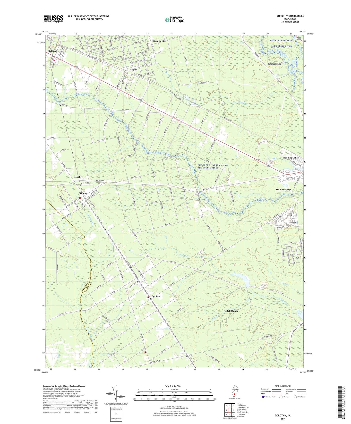
2019 topographic map quadrangle Dorothy in the state of New Jersey. Scale: 1:24000. Based on the newly updated USGS 7.5' US Topo map series, this map is in the following counties: Atlantic, Cumberland. The map contains contour data, water features, and other items you are used to seeing on USGS maps, but also has updated roads and other features. This is the next generation of topographic maps. Printed on high-quality waterproof paper with UV fade-resistant inks.
Quads adjacent to this one:
West: Five Points
Northwest: Buena
North: Newtonville
Northeast: Egg Harbor City
East: Mays Landing
Southeast: Marmora
South: Tuckahoe
Southwest: Port Elizabeth
Contains the following named places: Atlantic City Girl Scout Camp, Dorothy, Dorothy Census Designated Place, Dorothy Post Office, Dorothy Volunteer Fire Company, Doughty, Emmelsville, Estell Manor Post Office, Estell Manor School, Estell Manor Volunteer Fire Company, Gigantic City, Harding Lakes, James Branch, Maple Lake, Maple Lake Dam, Mare Run, Milmay, Milmay Census Designated Place, Milmay Post Office, Milmay Volunteer Fire Company, Mizpah, Mizpah Census Designated Place, Mizpah Post Office, Mizpah Volunteer Fire Company, Mount Calvary Church, Mount Olive Church, Richland, Richland Post Office, Richland Volunteer Fire Company 1, Risley Station, Saint James Church, Saint Johns Church, School Number 5, Stephen Lake, Township of Weymouth, Walkers Forge, Weymouth Township Elementary School, ZIP Code: 08317