MyTopo
Fortescue New Jersey US Topo Map
Couldn't load pickup availability
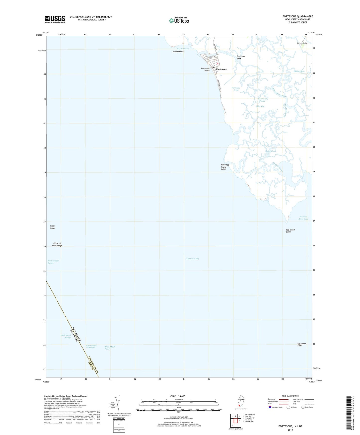
2019 topographic map quadrangle Fortescue in the state of New Jersey. Scale: 1:24000. Based on the newly updated USGS 7.5' US Topo map series, this map is in the following counties: Cumberland, Kent. The map contains contour data, water features, and other items you are used to seeing on USGS maps, but also has updated roads and other features. This is the next generation of topographic maps. Printed on high-quality waterproof paper with UV fade-resistant inks.
Quads adjacent to this one:
Northwest: Ben Davis Point
North: Cedarville
Northeast: Dividing Creek
East: Port Norris
Southwest: Bennetts Pier
Contains the following named places: Beadon Cove, Beadon Creek, Beadon Point, Boiler Creek, Brandywine Range, Courtney Ponds, Cross Ledge, Downe Township Fire and Rescue Fortescue Company 1 - Station 39, Egg Island, Egg Island Fish and Wildlife Management Area, Egg Island Flats, Egg Island Point, Elbow of Cross Ledge, Elder Gut, False Egg Island Point, Fishing Creek, Fortescue, Fortescue Beach, Fortescue Census Designated Place, Fortescue Creek, Fortescue Post Office, Indian Ditch, Johnsons Ditch, King Pond, Lower Brothers Creek, McCormick Pond, Miah Maull Range, Middle Brothers Creek, Oyster Creek, Piersons Ditch, Raybins Beach, Straight Creek, The Three Mouths, Upper Brothers Creek, Widgeon Ponds, Wilmas Pond, ZIP Code: 08321