MyTopo
Indian Mills New Jersey US Topo Map
Couldn't load pickup availability
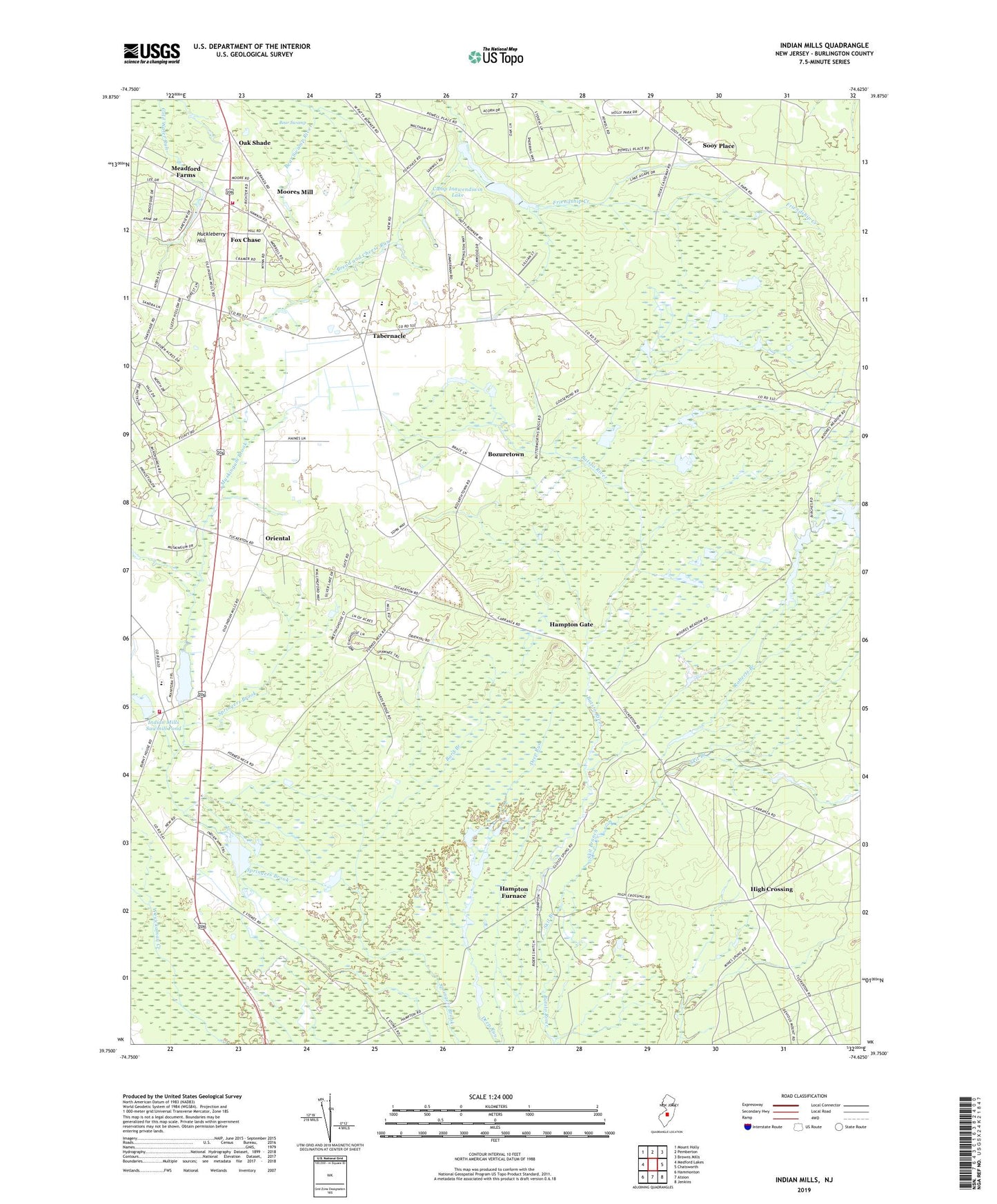
2019 topographic map quadrangle Indian Mills in the state of New Jersey. Scale: 1:24000. Based on the newly updated USGS 7.5' US Topo map series, this map is in the following counties: Burlington. The map contains contour data, water features, and other items you are used to seeing on USGS maps, but also has updated roads and other features. This is the next generation of topographic maps. Printed on high-quality waterproof paper with UV fade-resistant inks.
Quads adjacent to this one:
West: Medford Lakes
Northwest: Mount Holly
North: Pemberton
Northeast: Browns Mills
East: Chatsworth
Southeast: Jenkins
South: Atsion
Southwest: Hammonton
Contains the following named places: Bard Branch, Bozuretown, Bread and Cheese Run, Camp Inawendiwin, Camp Inawendiwin Dam, Camp Inawendiwin Lake, Carranza Memorial, Conte Farms, Fox Chase, Friendship, Hampton Furnace, Hampton Gate, Hampton Station, High Crossing, Huckleberry Hill, Indian Mills, Indian Mills Brook, Indian Mills Dam, Indian Mills Elementary School, Indian Mills Lake, Indian Mills Sawmill Dam, Indian Mills Sawmill Pond, Indian Mills Volunteer Fire Company, Kenneth R Olson Middle School, Meadford Farms, Moores Mill, Muskingum Brook, Oak Shade, Oriental, Roberts Branch, Russo's Fruit And Vegetable Farm, Seneca High School, Shamong Emergency Medical Services, Skit Branch, Sooy Place, Tabernacle, Tabernacle Elementary School, Tabernacle Fire Company, Tabernacle Rescue Squad, Township of Shamong, Township of Tabernacle, ZIP Code: 08088