MyTopo
Animas Peak NE New Mexico US Topo Map
Couldn't load pickup availability
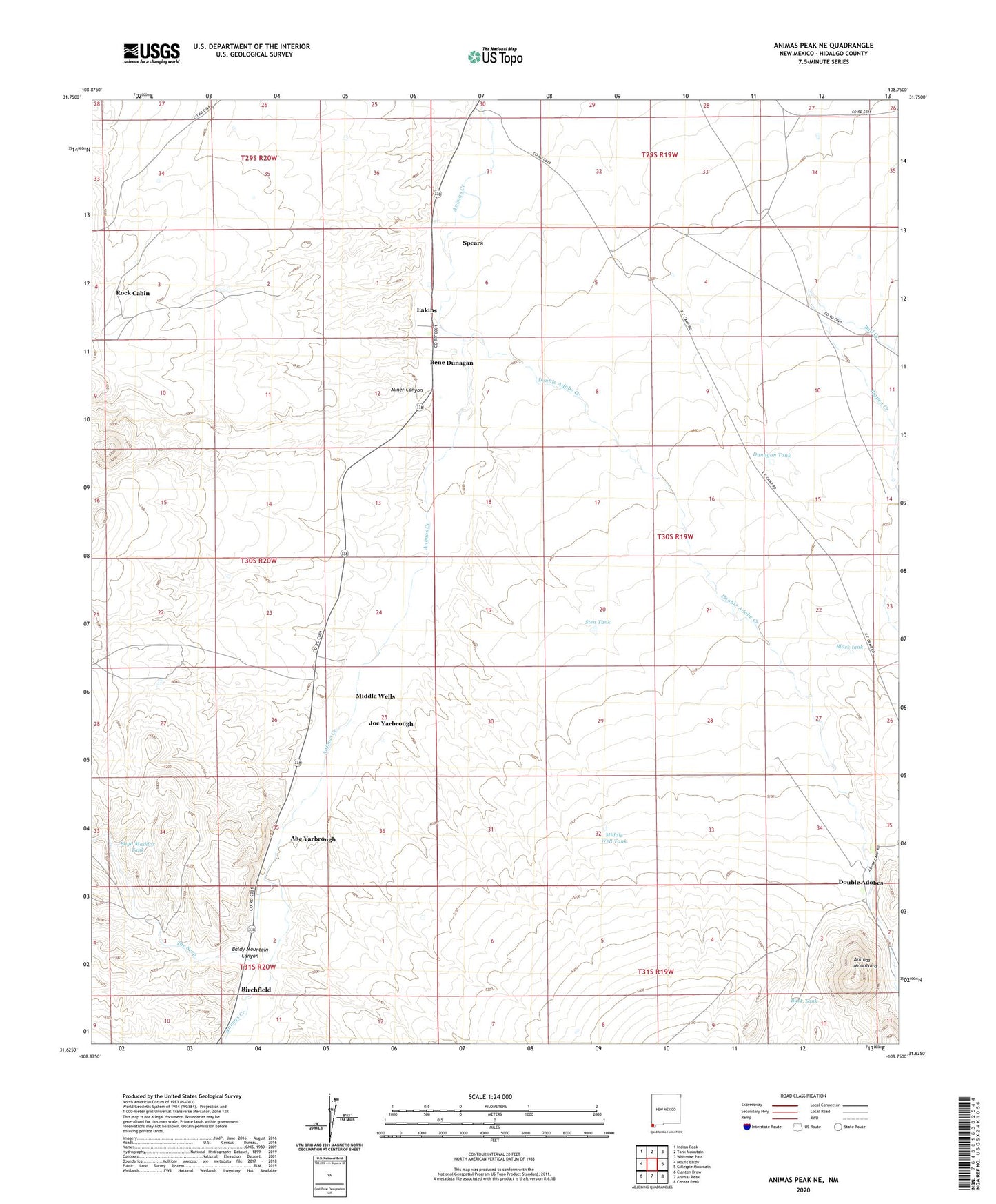
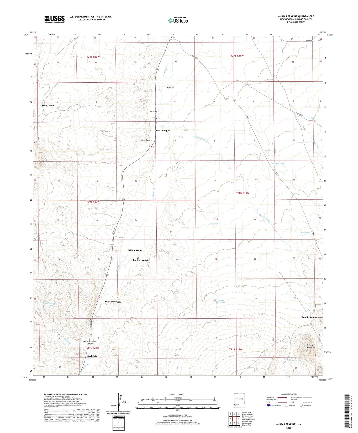
2020 topographic map quadrangle Animas Peak NE in the state of New Mexico. Scale: 1:24000. Based on the newly updated USGS 7.5' US Topo map series, this map is in the following counties: Hidalgo. The map contains contour data, water features, and other items you are used to seeing on USGS maps, but also has updated roads and other features. This is the next generation of topographic maps. Printed on high-quality waterproof paper with UV fade-resistant inks.
Quads adjacent to this one:
West: Mount Baldy
Northwest: Indian Peak
North: Tank Mountain
Northeast: Whitmire Pass
East: Gillespie Mountain
Southeast: Center Peak
South: Animas Peak
Southwest: Clanton Draw
Contains the following named places: Abe Yarbrough, Baldy Mountain Canyon, Bene Dunagan, Birchfield, Black tank, Boyd Maddox Tank, Buck Tank, Bull Creek, Deep Windmill, Double Adobe Creek, Double Adobe Creek Historic Site, Double Adobes, Dunagan Tank, Eakins, Joe Yarbrough, LA 54021, Maddox School, Middle Well Tank, Middle Wells, Miner Canyon, Rock Cabin, Spears, Sten Tank, Steve Dunagan, The Seep, Walter Dunagan, X T Ranch