MyTopo
Tank Mountain New Mexico US Topo Map
Couldn't load pickup availability
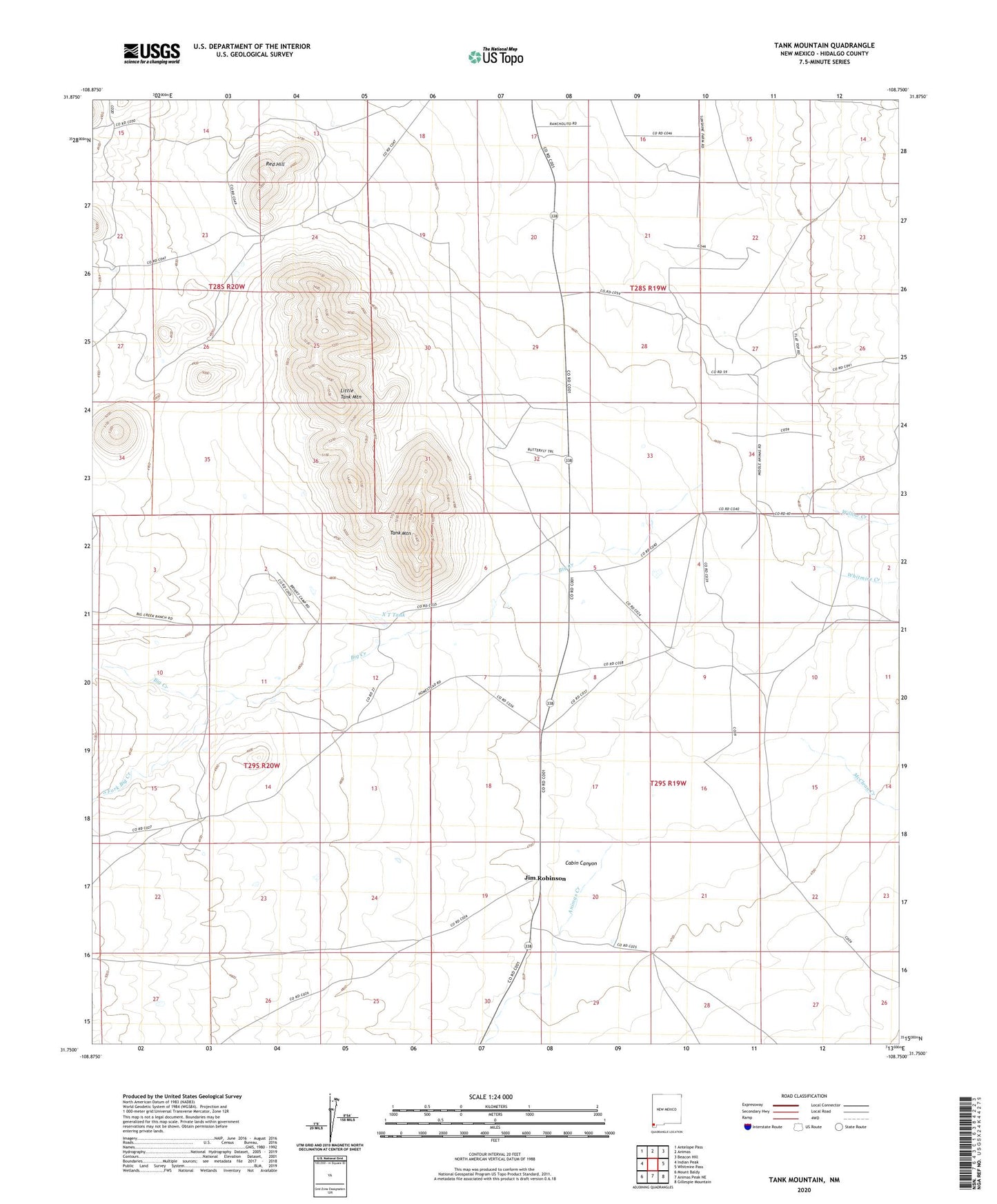
2023 topographic map quadrangle Tank Mountain in the state of New Mexico. Scale: 1:24000. Based on the newly updated USGS 7.5' US Topo map series, this map is in the following counties: Hidalgo. The map contains contour data, water features, and other items you are used to seeing on USGS maps, but also has updated roads and other features. This is the next generation of topographic maps. Printed on high-quality waterproof paper with UV fade-resistant inks.
Quads adjacent to this one:
West: Indian Peak
Northwest: Antelope Pass
North: Animas
Northeast: Beacon Hill
East: Whitmire Pass
Southeast: Gillespie Mountain
South: Animas Peak NE
Southwest: Mount Baldy
This map covers the same area as the classic USGS quad with code o31108g7.
Contains the following named places: 10145 Water Well, 10146 Water Well, 10157 Water Well, 88020, Animas Creek, Big Creek, Cabin Canyon, Gibson Place, Jim Robinson, Jim Robinson Ranch, Little Tank Mountain, McClean Creek, Middle Animas Cemetery, Old Maddox School, Pages Store, Red Hill, South Fork Big Creek, Tank Mountain, Tase Golman, Whitmire Creek, Willow Creek, X T Tank