MyTopo
Gillespie Mountain New Mexico US Topo Map
Couldn't load pickup availability
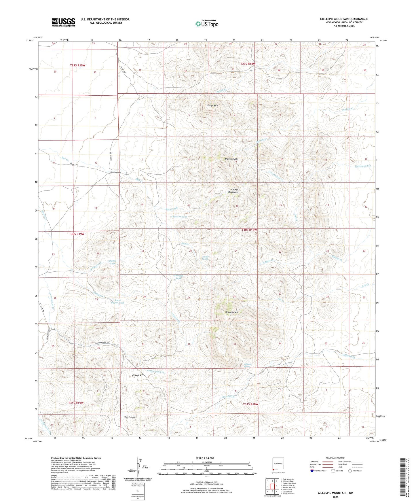
2023 topographic map quadrangle Gillespie Mountain in the state of New Mexico. Scale: 1:24000. Based on the newly updated USGS 7.5' US Topo map series, this map is in the following counties: Hidalgo. The map contains contour data, water features, and other items you are used to seeing on USGS maps, but also has updated roads and other features. This is the next generation of topographic maps. Printed on high-quality waterproof paper with UV fade-resistant inks.
Quads adjacent to this one:
West: Animas Peak NE
Northwest: Tank Mountain
North: Whitmire Pass
Northeast: Playas Lake South
East: Walnut Wells NE
Southeast: Horse Mountain
South: Center Peak
Southwest: Animas Peak
This map covers the same area as the classic USGS quad with code o31108f6.
Contains the following named places: Anderson Mountain, Anderson Tank, Athena Mine, Athena Prospect Number 2, Basin Tank, Bennett Ranch, Cottonwood Creek, Gillespie Mine, Gillespie Mountain, Gillespie Spring, Gillespie Tank, Godfrey Ranch, Juniper Spring, Maverick Flat, North Pigpen Creek, Oak Creek, Pigpen Creek, Pigpen Tank, Ridge Claims, Rough Mountain, South Hidalgo Division, South Pigpen Creek, South Pigpen Tank, Upshaw Place, West Pigpen Creek, Winkler Ranch, Yarbrough Place