MyTopo
Animas Peak New Mexico US Topo Map
Couldn't load pickup availability
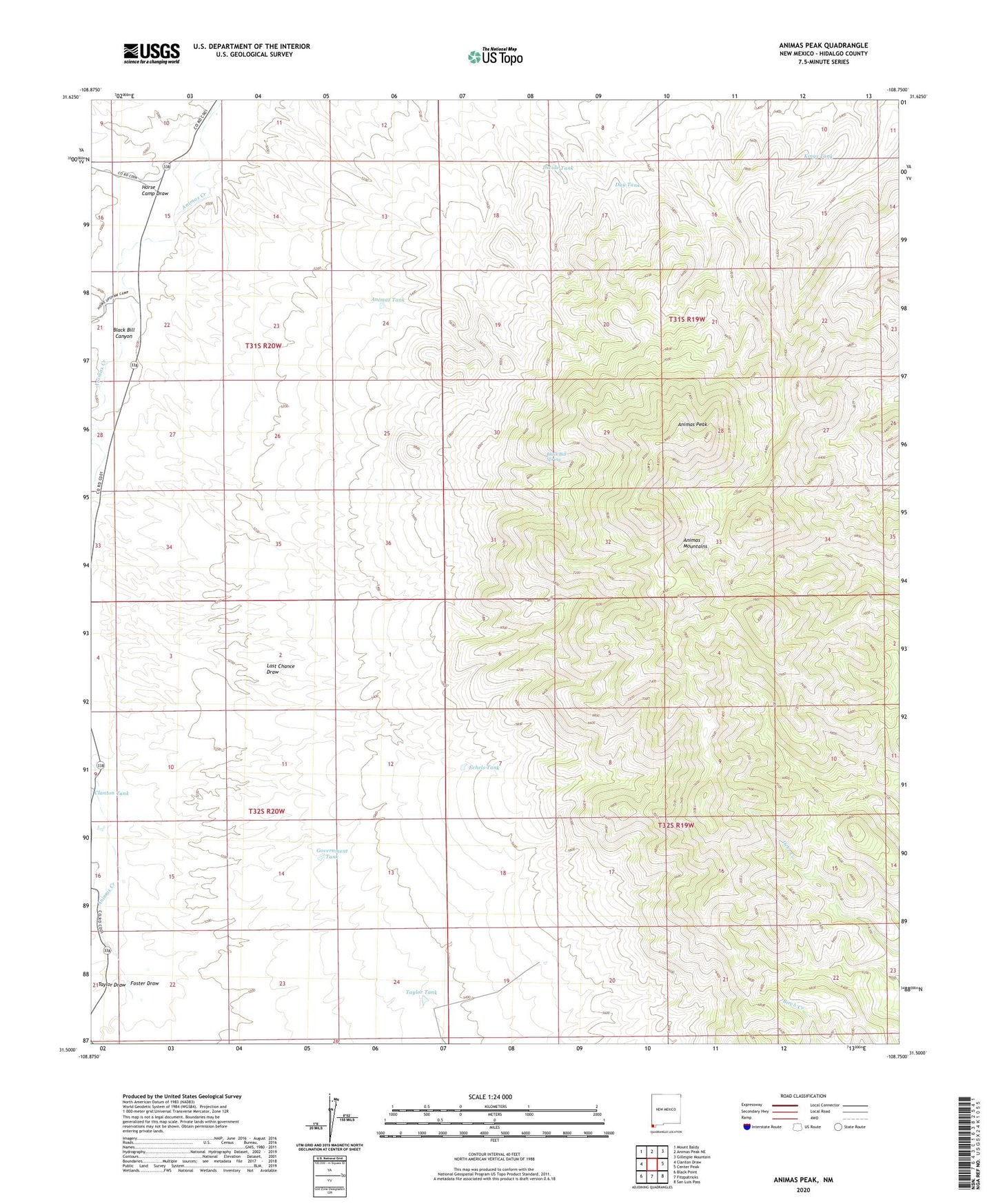
2023 topographic map quadrangle Animas Peak in the state of New Mexico. Scale: 1:24000. Based on the newly updated USGS 7.5' US Topo map series, this map is in the following counties: Hidalgo. The map contains contour data, water features, and other items you are used to seeing on USGS maps, but also has updated roads and other features. This is the next generation of topographic maps. Printed on high-quality waterproof paper with UV fade-resistant inks.
Quads adjacent to this one:
West: Clanton Draw
Northwest: Mount Baldy
North: Animas Peak NE
Northeast: Gillespie Mountain
East: Center Peak
Southeast: San Luis Pass
South: Fitzpatricks
Southwest: Black Point
This map covers the same area as the classic USGS quad with code o31108e7.
Contains the following named places: Animas Mountains, Animas Peak, Animas Tank, Bercham Draw, Black Bill Canyon, Black Bill Spring, Clanton Draw, Day Tank, Divide Tank, Echels Tank, Foster Draw, Government Tank, Gray Ranch, Gray School, Horse Camp Draw, Horse Camp Wells, Howe Ranch, Kings Tank, Taylor Draw, Taylor Tank, Upshaw Tank