MyTopo
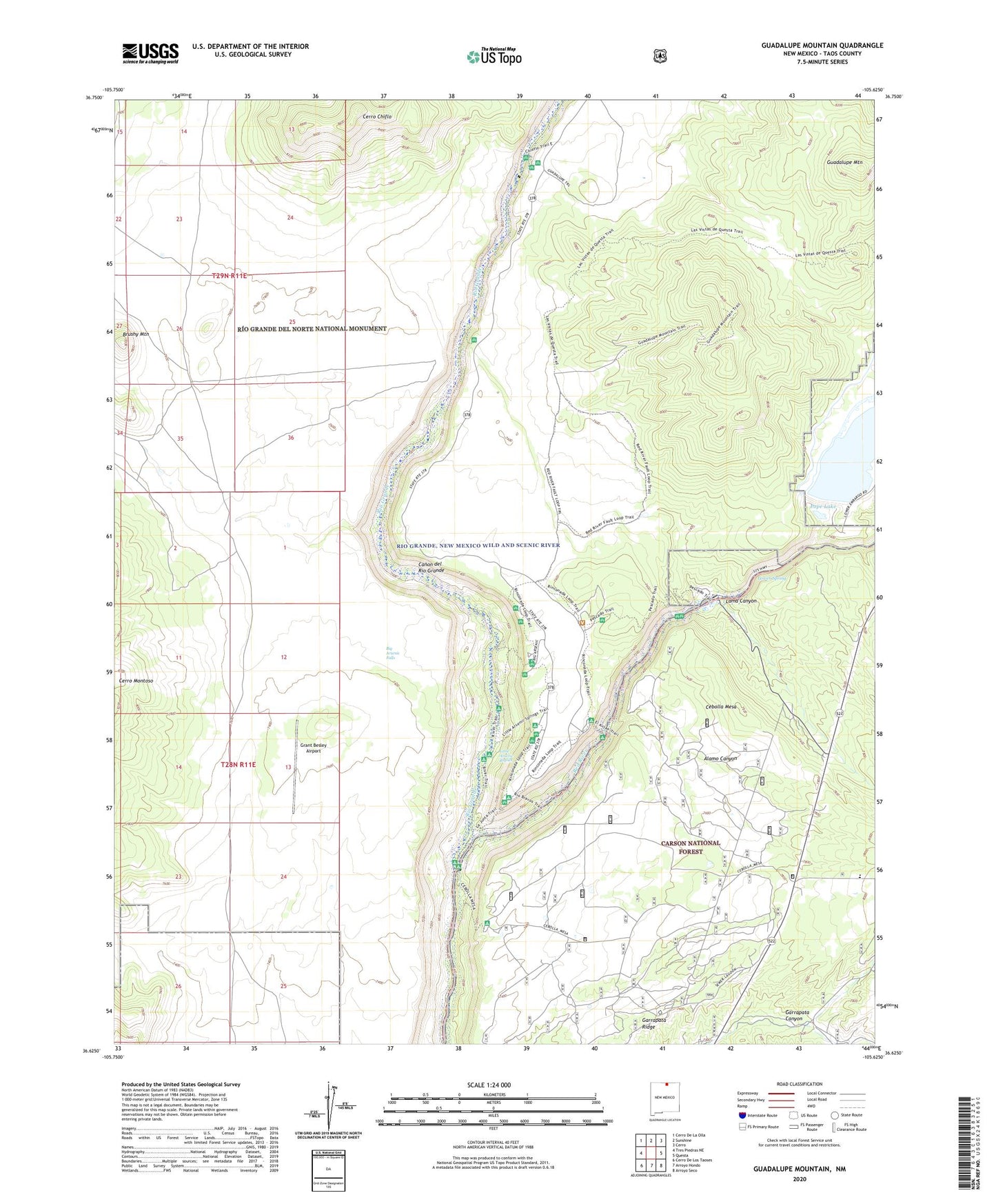
Guadalupe Mountain New Mexico US Topo Map
Couldn't load pickup availability
Also explore the Guadalupe Mountain Forest Service Topo of this same quad for updated USFS data
2023 topographic map quadrangle Guadalupe Mountain in the state of New Mexico. Scale: 1:24000. Based on the newly updated USGS 7.5' US Topo map series, this map is in the following counties: Taos. The map contains contour data, water features, and other items you are used to seeing on USGS maps, but also has updated roads and other features. This is the next generation of topographic maps. Printed on high-quality waterproof paper with UV fade-resistant inks.
Quads adjacent to this one:
West: Tres Piedras NE
Northwest: Cerro De La Olla
North: Sunshine
Northeast: Cerro
East: Questa
Southeast: Arroyo Seco
South: Arroyo Hondo
Southwest: Cerro De Los Taoses
This map covers the same area as the classic USGS quad with code o36105f6.
Contains the following named places: Alamo Canyon, Big Arsenic Falls, Big Arsenic Springs Campground, Brushy Mountain, Cebolia Mesa Campground, Cebolla Mesa, Cerro Chiflo, Chiflo Campground, El Aujae Campground, Garrapata Ridge, Grant Besley Airport, Guadalupe Mountain, Guadalupe Placer, La Junta Campground, Lama Canyon, Little Arsenic Rapids, Little Arsenic Springs Campground, Lower Spring, Pope Lake, Questa Tailing Dam Number Four, Red River, Red River State Fish Hatchery, RG-17985 Water Well, Rio Grande Wild and Scenic River Visitor Center, Test Hole 9A Water Well, Testhole 7A Water Well