MyTopo
Aurora New Mexico US Topo Map
Couldn't load pickup availability
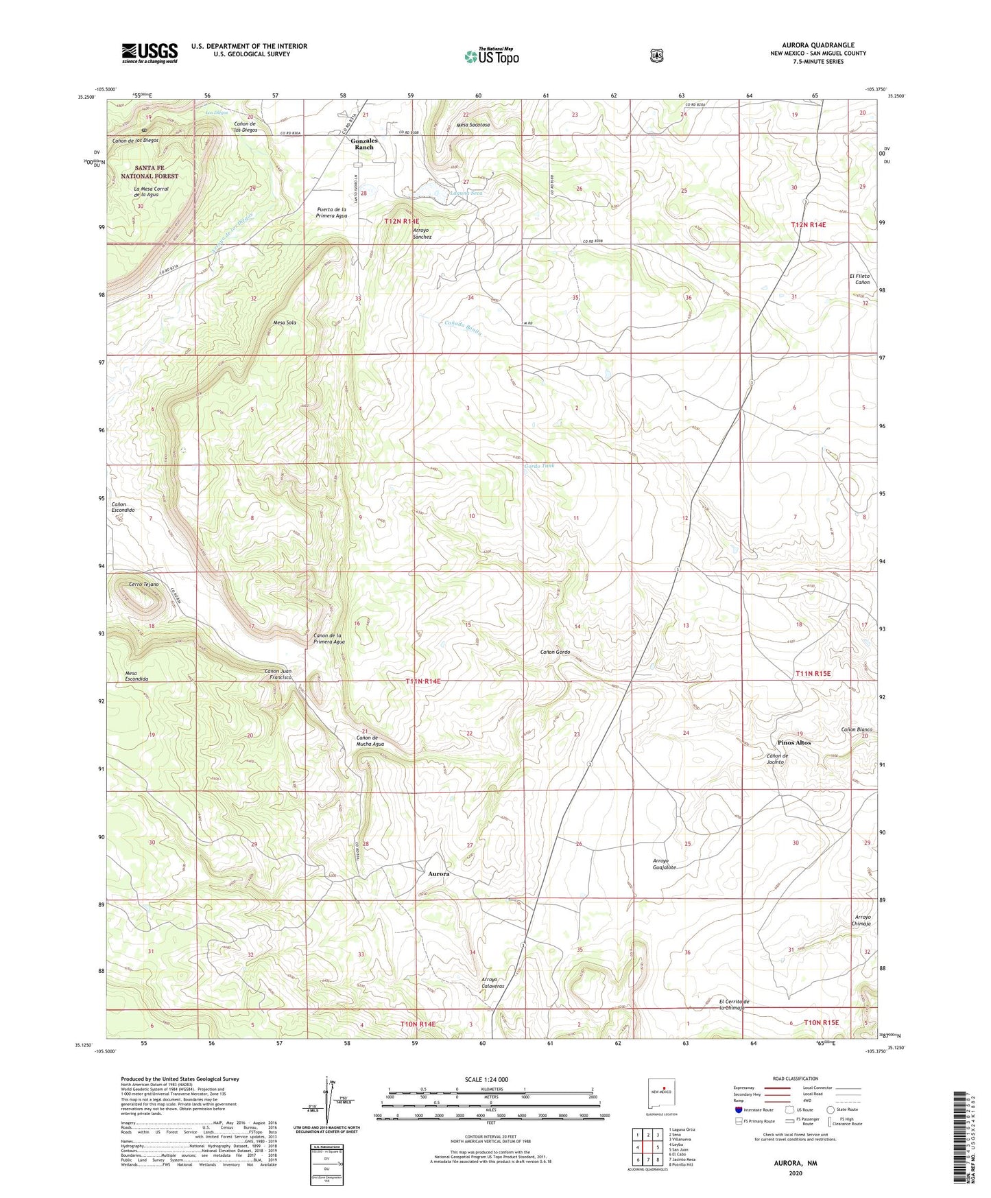
2020 topographic map quadrangle Aurora in the state of New Mexico. Scale: 1:24000. Based on the newly updated USGS 7.5' US Topo map series, this map is in the following counties: San Miguel. The map contains contour data, water features, and other items you are used to seeing on USGS maps, but also has updated roads and other features. This is the next generation of topographic maps. Printed on high-quality waterproof paper with UV fade-resistant inks.
Quads adjacent to this one:
West: Leyba
Northwest: Laguna Ortiz
North: Sena
Northeast: Villanueva
East: San Juan
Southeast: Potrillo Hill
South: Jacinto Mesa
Southwest: El Cabo
Contains the following named places: Arroyo Calaveras, Arroyo de los Diegos, Arroyo Guajalote, Aurora, Aurora Post Office, Aurora Weather Station, Benevides Ranch, Bustos Well, Canada Bonita, Canon de Jacinto, Canon de la Primera Agua, Canon de los Diegos, Canon de Mucha Agua, Canon Escondido, Canon Gordo, Canon Juan Francisco, Cerro Tejano, East Windmill, El Cerrito de la Chimaja, Gonzales Ranch, Gonzales Ranch Post Office, Gonzales Ranch School, Gordo Tank, Laguna Seca, Los Diegos, Mesa Sola, North Tank, Pablo Sena Ranch, Pinos Altos, Puerta de la Primera Agua, Santa Teresita Church, Snyder Ranch, West Tank