MyTopo
Sena New Mexico US Topo Map
Couldn't load pickup availability
Also explore the Sena Forest Service Topo of this same quad for updated USFS data
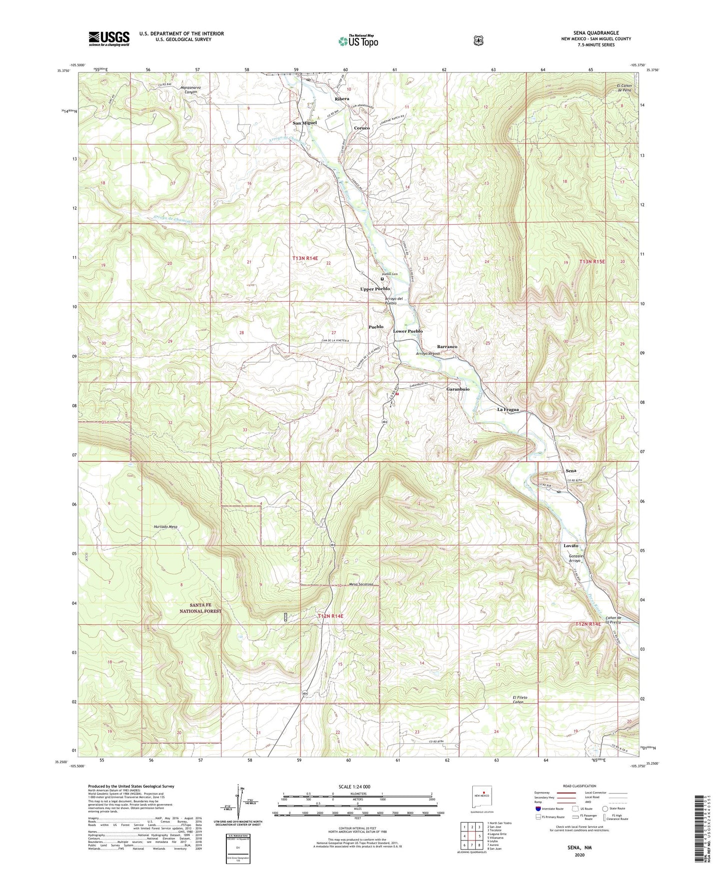
2023 topographic map quadrangle Sena in the state of New Mexico. Scale: 1:24000. Based on the newly updated USGS 7.5' US Topo map series, this map is in the following counties: San Miguel. The map contains contour data, water features, and other items you are used to seeing on USGS maps, but also has updated roads and other features. This is the next generation of topographic maps. Printed on high-quality waterproof paper with UV fade-resistant inks.
Quads adjacent to this one:
West: Laguna Ortiz
Northwest: North San Ysidro
North: San Jose
Northeast: Tecolote
East: Villanueva
Southeast: San Juan
South: Aurora
Southwest: Leyba
This map covers the same area as the classic USGS quad with code o35105c4.
Contains the following named places: Arroyo de Chamizal, Arroyo del Pueblo, Arroyo Vegoso, Barranco, Canon de la Presta, Coruco, Flowing Well, Garanbuio, Garanbuio Dam, Gonzales Arroyo, Health Centers of Northern New Mex San Miguel Clinic, La Fragua, Leyba, Los Diegos, Los Trigos Dam, Los Trigos Ditch, Lovato, Lovato Dam, Lovato Ditch, Lower Pueblo, Manzanarez Canyon, Mesa Sacatosa, New Life Assembly of God, Pueblo Cemetery, Pueblo Census Designated Place, Pueblo Dam, Pueblo Ditch, Ribera, Ribera Census Designated Place, Ribera Ditch, Ribera Post Office, San Miguel, San Miguel County Fire District El Pueblo Fire Department, San Miguel Del Bado Tract Number 2, San Miguel Del Bado Tract Number 7, San Miguel del Vado Historic District, San Miguel Post Office, Sedan Post Office, Sena, Sena Census Designated Place, Sena Dam, Sena Ditch, Upper Pueblo, Valley Junior High School, Villanueva Dam