MyTopo
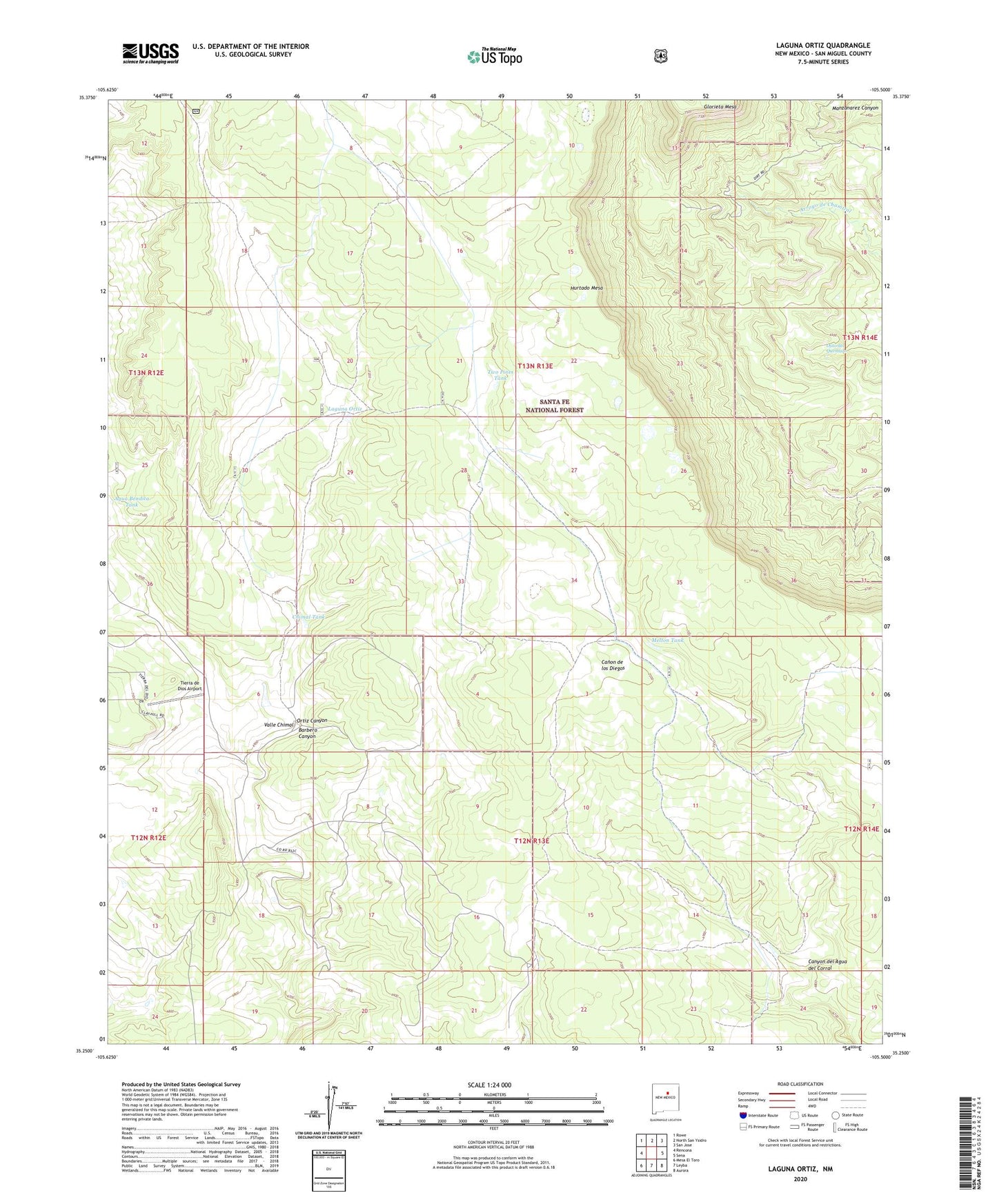
Laguna Ortiz New Mexico US Topo Map
Couldn't load pickup availability
Also explore the Laguna Ortiz Forest Service Topo of this same quad for updated USFS data
2023 topographic map quadrangle Laguna Ortiz in the state of New Mexico. Scale: 1:24000. Based on the newly updated USGS 7.5' US Topo map series, this map is in the following counties: San Miguel. The map contains contour data, water features, and other items you are used to seeing on USGS maps, but also has updated roads and other features. This is the next generation of topographic maps. Printed on high-quality waterproof paper with UV fade-resistant inks.
Quads adjacent to this one:
West: Rencona
Northwest: Rowe
North: North San Ysidro
Northeast: San Jose
East: Sena
Southeast: Aurora
South: Leyba
Southwest: Mesa El Toro
This map covers the same area as the classic USGS quad with code o35105c5.
Contains the following named places: Agua Bendita Tank, Barbero Canyon, Canyon del Agua del Corral, Chimal Tank, Clark Ranch, Corner Tank, Cresprin Well, Division Tank, Hidden Tank, Hurtado Mesa, Laguna Ortiz, Lopez Tank, Madrid Tank, Madrid Well, Marquez Tank, Melton Tank, Ojito del Quemado, Ortiz Canyon, Palmer Tank, Tierra de Dios Airport, Two Pines Tank, White Ranch, Wildlife Trick Tank