MyTopo
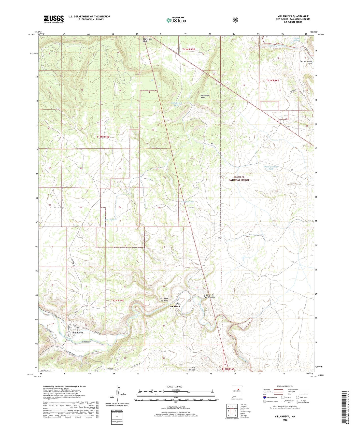
Villanueva New Mexico US Topo Map
Couldn't load pickup availability
Also explore the Villanueva Forest Service Topo of this same quad for updated USFS data
2023 topographic map quadrangle Villanueva in the state of New Mexico. Scale: 1:24000. Based on the newly updated USGS 7.5' US Topo map series, this map is in the following counties: San Miguel. The map contains contour data, water features, and other items you are used to seeing on USGS maps, but also has updated roads and other features. This is the next generation of topographic maps. Printed on high-quality waterproof paper with UV fade-resistant inks.
Quads adjacent to this one:
West: Sena
Northwest: San Jose
North: Tecolote
Northeast: Los Montoyas
East: Apache Springs
Southeast: Anton Chico
South: San Juan
Southwest: Aurora
This map covers the same area as the classic USGS quad with code o35105c3.
Contains the following named places: Cattleguard Tank, Cerritos Tank, Dos Lagunas, El Canon de Pena, El Canon del Palo Amarillo, El Cerrito, El Cerrito Post Office, El Pueblo Well, Head Quarters Tank, KBAC-FM (Las Vegas), Lagunita Springs, Leguino Tank, Middle Tank, Quintana Forest Service Station, Road Tank, San Miguel Del Bado Tract Number 1, Sombodoro Mesa, Valley Elementary School, Valley Junior High School, Villanueva, Villanueva Census Designated Place, Villanueva Northside Ditch, Villanueva Post Office, Villanueva Southside Ditch, Villanueva State Park, Villanueva Weather Station, ZIP Code: 87569