MyTopo
Aztec New Mexico US Topo Map
Couldn't load pickup availability
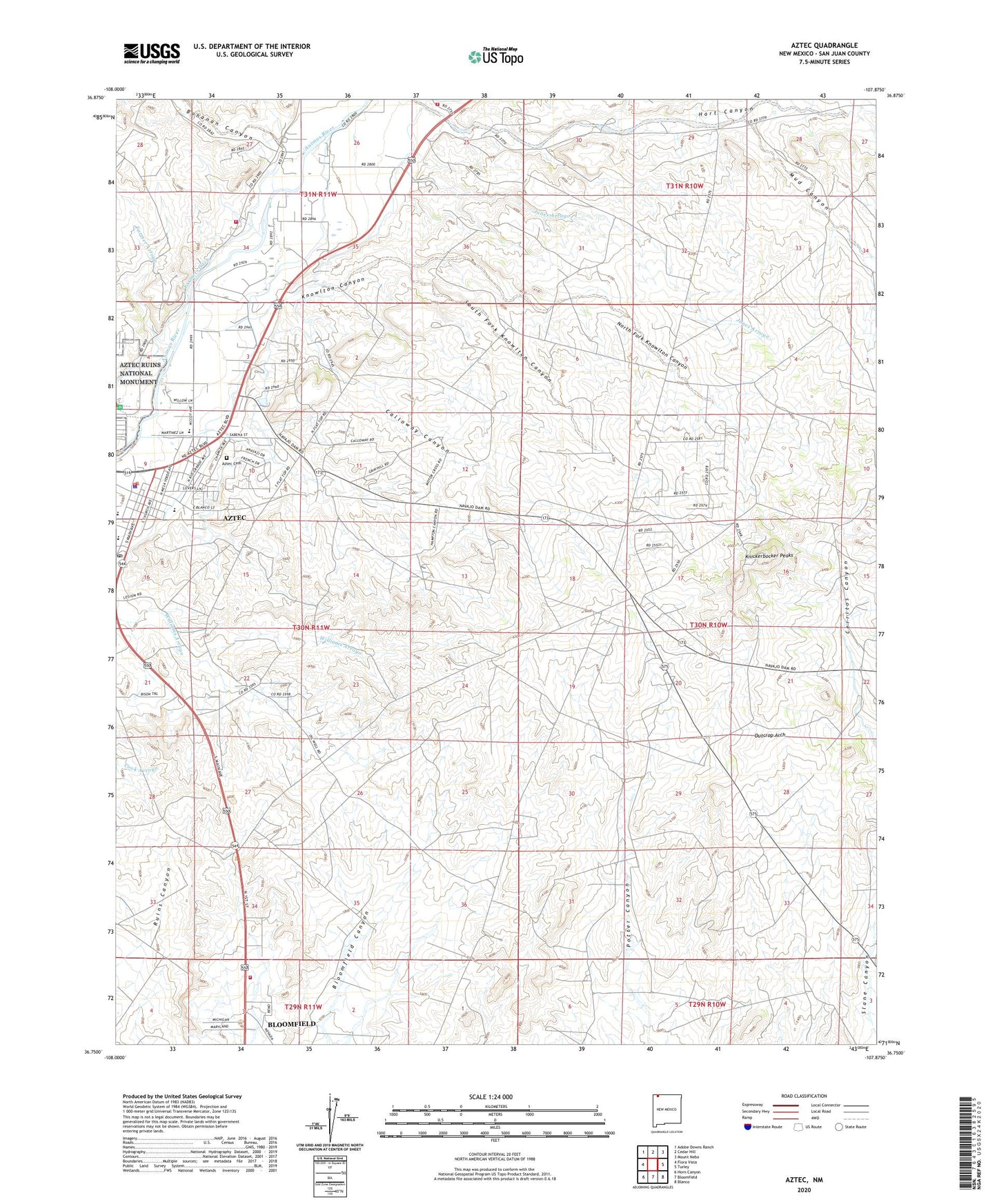
2020 topographic map quadrangle Aztec in the state of New Mexico. Scale: 1:24000. Based on the newly updated USGS 7.5' US Topo map series, this map is in the following counties: San Juan. The map contains contour data, water features, and other items you are used to seeing on USGS maps, but also has updated roads and other features. This is the next generation of topographic maps. Printed on high-quality waterproof paper with UV fade-resistant inks.
Quads adjacent to this one:
West: Flora Vista
Northwest: Adobe Downs Ranch
North: Cedar Hill
Northeast: Mount Nebo
East: Turley
Southeast: Blanco
South: Bloomfield
Southwest: Horn Canyon
Contains the following named places: Alturian Library, Alturian Public Library, American Hotel Historic Site, Assembly of God Church, Austin-McDonald House Historic Site, Aztec, Aztec Cemetery, Aztec Christian Church, Aztec Ditch, Aztec Fire Department, Aztec First Church of the Nazarene, Aztec Gun Club, Aztec High School, Aztec Historical Marker, Aztec Main Street Historic District, Aztec Motor Company Building Historic Site, Aztec Museum, Aztec Police Department, Aztec Post Office, Aztec Presbyterian Church, Aztec Ruins National Monument, Aztec Ruins National Monument Historical Marker, Aztec Weather Station, Bible Baptist Church, Bloomfield Fire Department Station 2, Bohanan Canyon, Brethel Baptist Church, C V Junior High School, Calloway Canyon, Center Point Census Designated Place, Church Avenue - Lovers Lane Historic District, Church of Christ, Church of God of the Apostolic Faith, City of Aztec, D C Ball House Historic Site, Daws-Keys House Historic Site, Denver and Rio Grande Western Railway Depot, Engleman-Thomas Building Historic Site, Farmer Arroyo, First Baptist Church, First United Methodist Church, Fred Bunker House Historic Site, H D Abrams House Historic Site, Hampton Arroyo, Hart Canyon, Harvey McCoy House Historic Site, James McGee House Historic Site, Jesus Saves Trinity Church, Jones Arroyo, Knickerbocker Peaks, Knowlton Canyon, KRAZ-FM (Farmington), KTRA-FM (Farmington), Lydia Rippey Elementary School, Maurice Case House Historic Site, McCoy Avenue Elementary School, McCoy Avenue School, McCoy-Maddox House Historic Site, Mud Canyon, North Fork Knowlton Canyon, Outcrop Arch, Park Avenue Elementary School, Ruins Canyon, Saint Josephs Catholic Church, San Juan County Fire District 3 - Cedar Hill Station 2, San Juan County Fire District 7 - Center Point, Seventh Day Adventist - Aztec Church, Seventh Day Adventist Church, South Fork Knowlton Canyon, The Church of Jesus Christ of Latter Day Saints, ZIP Code: 87410