MyTopo
Turley New Mexico US Topo Map
Couldn't load pickup availability
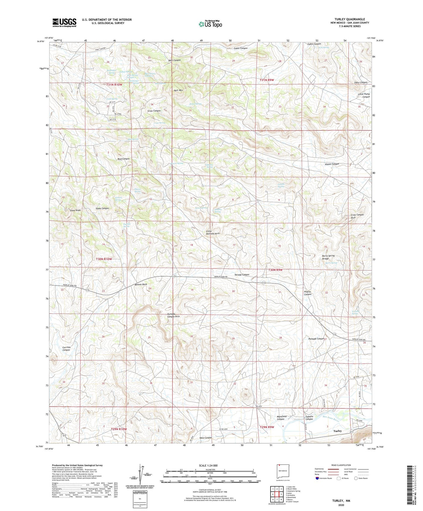
2023 topographic map quadrangle Turley in the state of New Mexico. Scale: 1:24000. Based on the newly updated USGS 7.5' US Topo map series, this map is in the following counties: San Juan. The map contains contour data, water features, and other items you are used to seeing on USGS maps, but also has updated roads and other features. This is the next generation of topographic maps. Printed on high-quality waterproof paper with UV fade-resistant inks.
Quads adjacent to this one:
West: Aztec
Northwest: Cedar Hill
North: Mount Nebo
Northeast: Anastacio Spring
East: Archuleta
Southeast: Cutter Canyon
South: Blanco
Southwest: Bloomfield
This map covers the same area as the classic USGS quad with code o36107g7.
Contains the following named places: Alamo Canyon, Alamo Spring, Alcatraz, Alcatraz Post Office, Banco Spring, Blanco Census Designated Place, Bonnie Rock, Bootlegger Spring, Burro Spring, Burro Spring Bridge, Caballo Canyon, Caballo Spring, Cash Spring, Cerritos Canyon, Crow Canyon Arch, Crow Spring, Hart Mountain, Hart Spring, Hart Spring Number 1, Hart Spring Number 2, Headwater Spring, Indian Spring, Jackson Spring, Kirk Spring, Little Delicate Arch, Mansfield Canyon, Mud Spring, Pemada Canyon, Pemada Canyon Arch, Pilares Canyon, Pilares Spring, Pueblito Spring, Rincon Spring, Sanchez Spring, Sidro Canyon, Slane Knob, Turley, Turley Cemetery, Turley Post Office, Vaca Canyon, Valencia Spring, Ventana Spring, Vereda Canyon