MyTopo
Cedar Hill New Mexico US Topo Map
Couldn't load pickup availability
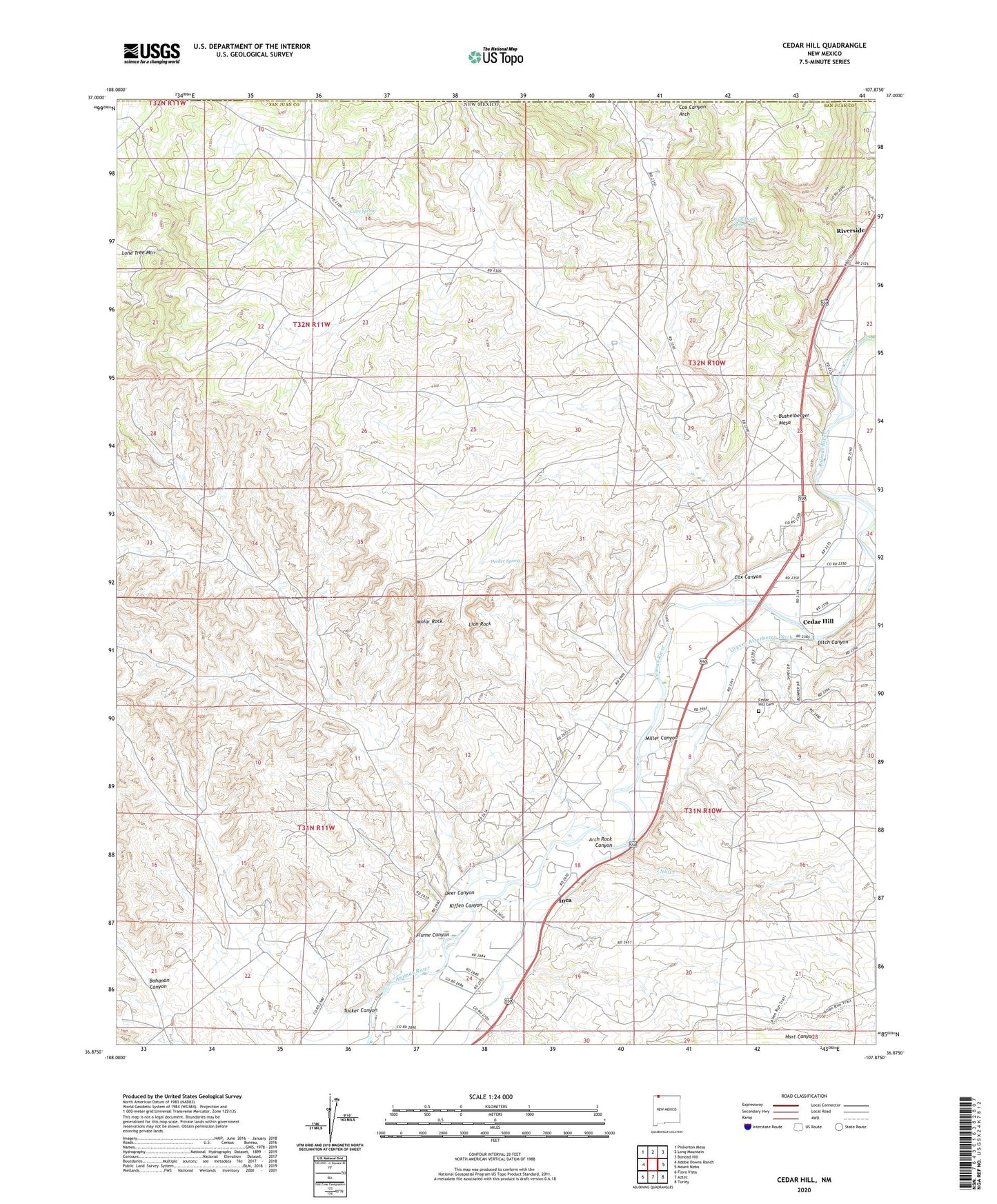
2023 topographic map quadrangle Cedar Hill in the state of New Mexico. Scale: 1:24000. Based on the newly updated USGS 7.5' US Topo map series, this map is in the following counties: San Juan. The map contains contour data, water features, and other items you are used to seeing on USGS maps, but also has updated roads and other features. This is the next generation of topographic maps. Printed on high-quality waterproof paper with UV fade-resistant inks.
Quads adjacent to this one:
West: Adobe Downs Ranch
Northwest: Pinkerton Mesa
North: Long Mountain
Northeast: Bondad Hill
East: Mount Nebo
Southeast: Turley
South: Aztec
Southwest: Flora Vista
This map covers the same area as the classic USGS quad with code o36107h8.
Contains the following named places: Arch Rock Canyon, Aztec Division, Bushelberger Mesa, Cave Spring, Cedar Ditch, Cedar Hill, Cedar Hill Cemetery, Cedar Hill Census Designated Place, Cedar Hill Post Office, Center Point, Cox Canyon, Cox Canyon Arch, Decker Spring, Deer Canyon, Ditch Canyon, Flume Canyon, Graves Atterberry Ditch, High Hopes Spring, Holmberg Lake, Inca, Kiffen Canyon, Lion Rock, Lone Tree Mountain, Miller Canyon, Molar Rock, Old Cedar Hill Cemetery, Riverside, San Juan County Fire District 3 - Cedar Hill Station 1, Sargent Ditch, SJ-2289 Water Well, Stacy Ditch, Tucker Canyon