MyTopo
Bighorn Peak New Mexico US Topo Map
Couldn't load pickup availability
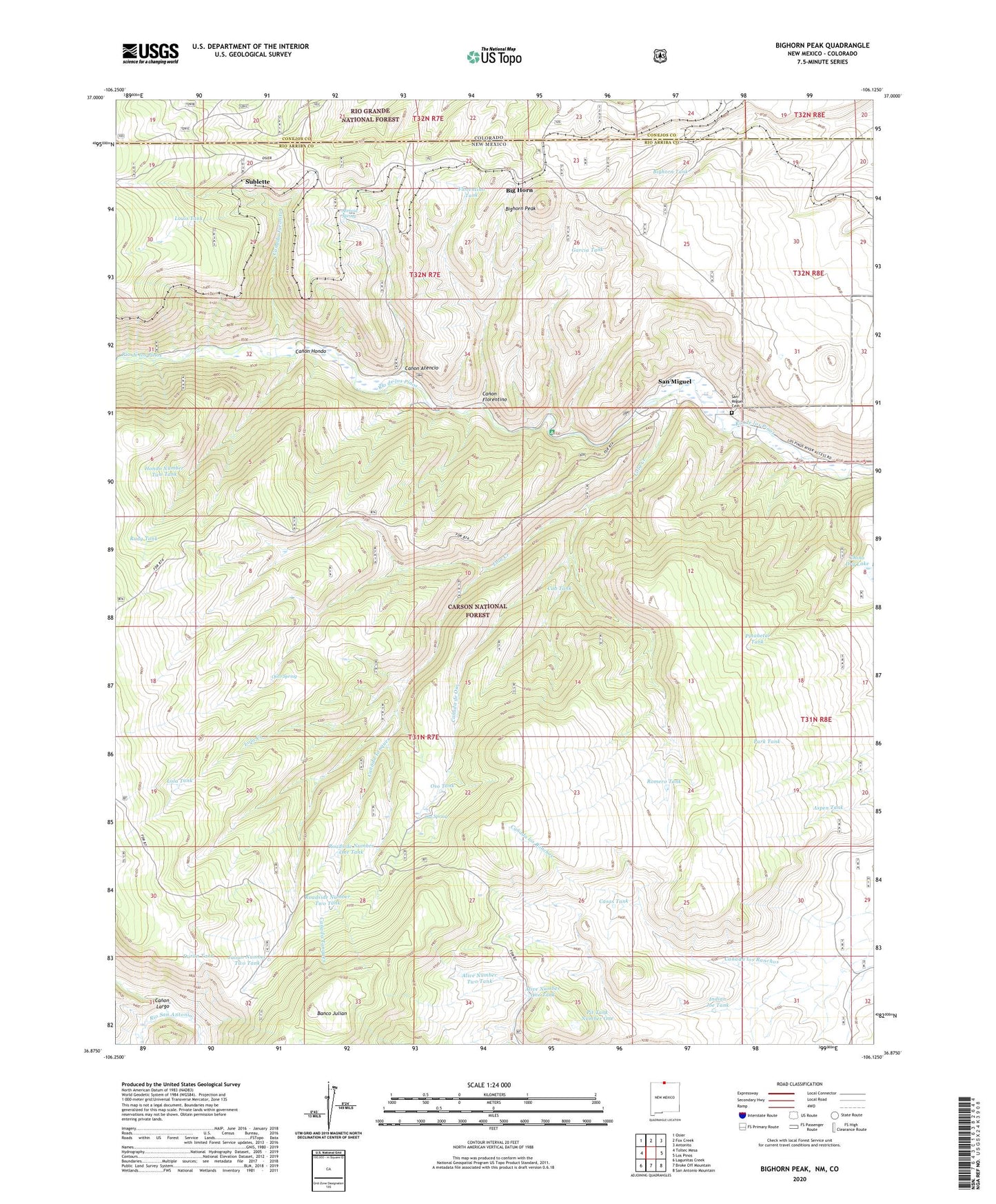
2020 topographic map quadrangle Bighorn Peak in the states of New Mexico, Colorado. Scale: 1:24000. Based on the newly updated USGS 7.5' US Topo map series, this map is in the following counties: Rio Arriba, Conejos. The map contains contour data, water features, and other items you are used to seeing on USGS maps, but also has updated roads and other features. This is the next generation of topographic maps. Printed on high-quality waterproof paper with UV fade-resistant inks.
Quads adjacent to this one:
West: Toltec Mesa
Northwest: Osier
North: Fox Creek
Northeast: Antonito
East: Los Pinos
Southeast: San Antonio Mountain
South: Broke Off Mountain
Southwest: Lagunitas Creek
Contains the following named places: Alive Number One Tank, Alive Number Two Tank, Aspen Tank, Atencio Spring, Banco Julian, Big Horn, Bighorn Peak, Bighorn Tank, Buck Tank Number 1, Buck Tank Number 2, Camino Tank, Canada de Oso, Canada Jarosita, Canada Tanques, Canon Atencio, Canon Florentino, Canon Hondo, Canon Largo, Casas Tank, Chino Dry Lake, Conejos Peak Ranger District, Cub Tank, Dale Tank, Duran Tank, Florentino Tank, Garcia Tank, Hondo Number One Tank, Hondo Number Two Tank, Indian Joe Tank, Julian Number Two Tank, Lola Creek, Lola Tank, Lola Tank Number Two, Louis Tank, Miguel Tank, New Mexico Game and Fish, Ojito Spring, Ojito Spring Tank, Oso Spring, Oso Tank, Park Tank, Pinabetal Tank, Pit Tank Number One, Rio De Los Pinos Campground, Roadside Number One Tank, Roadside Number Two Tank, Romero Tank, Rudy Tank, San Miguel, San Miguel Cemetery, Sublette, Valdez Tank