MyTopo
Billy Rice Canyon New Mexico US Topo Map
Couldn't load pickup availability
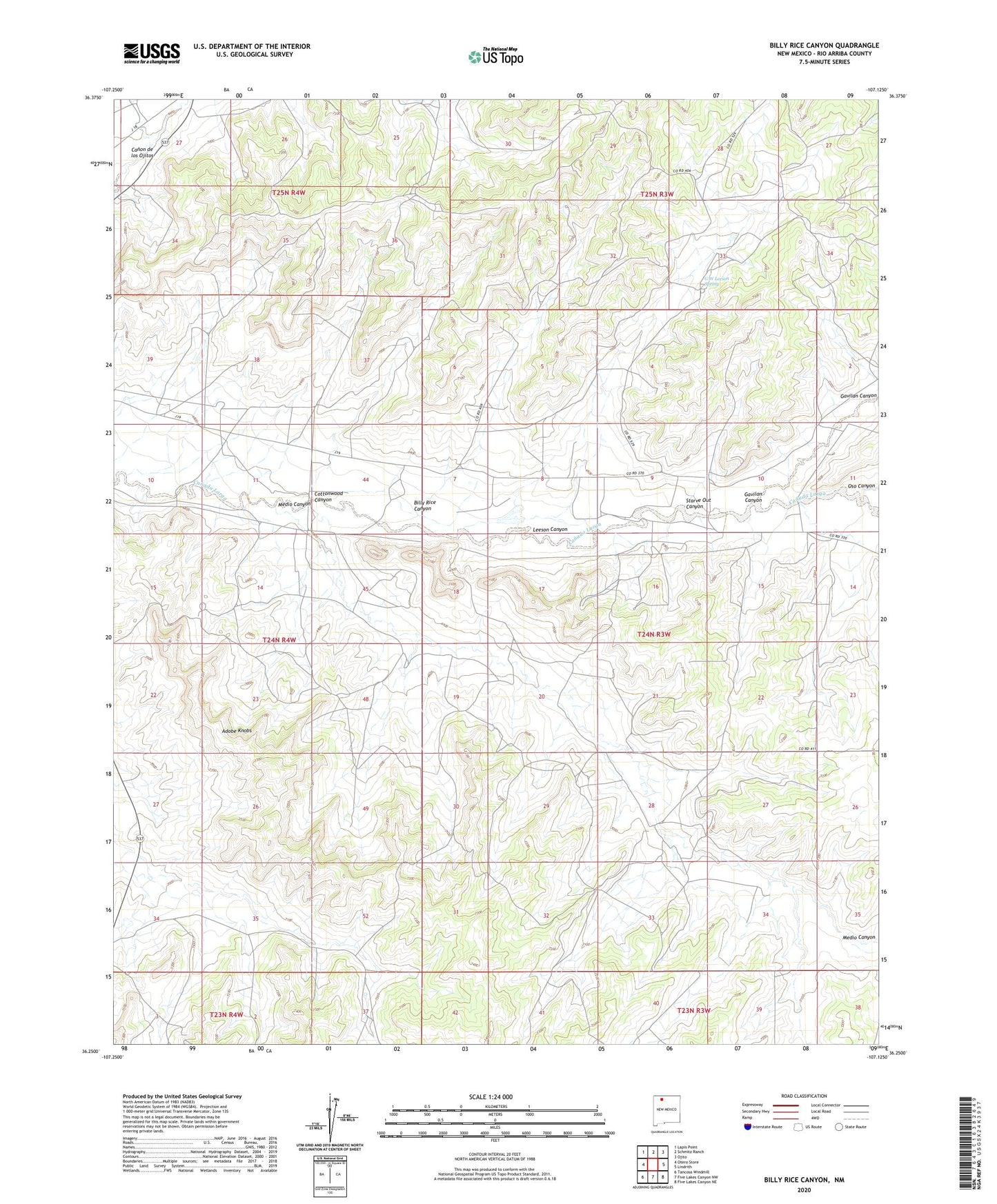
2023 topographic map quadrangle Billy Rice Canyon in the state of New Mexico. Scale: 1:24000. Based on the newly updated USGS 7.5' US Topo map series, this map is in the following counties: Rio Arriba. The map contains contour data, water features, and other items you are used to seeing on USGS maps, but also has updated roads and other features. This is the next generation of topographic maps. Printed on high-quality waterproof paper with UV fade-resistant inks.
Quads adjacent to this one:
West: Otero Store
Northwest: Lapis Point
North: Schmitz Ranch
Northeast: Ojito
East: Lindrith
Southeast: Five Lakes Canyon NE
South: Five Lakes Canyon NW
Southwest: Tancosa Windmill
This map covers the same area as the classic USGS quad with code o36107c2.
Contains the following named places: Adobe Knobs, Billy Rice Canyon, Cottonwood Canyon, G W Leeson Spring, Gavilan Canyon, Leeson Canyon, Leeson Ranch, Mary Becenti Water Well, Medio Canyon, Oso Canyon, Post Ranch, Starve Out Canyon, White Ranch