MyTopo
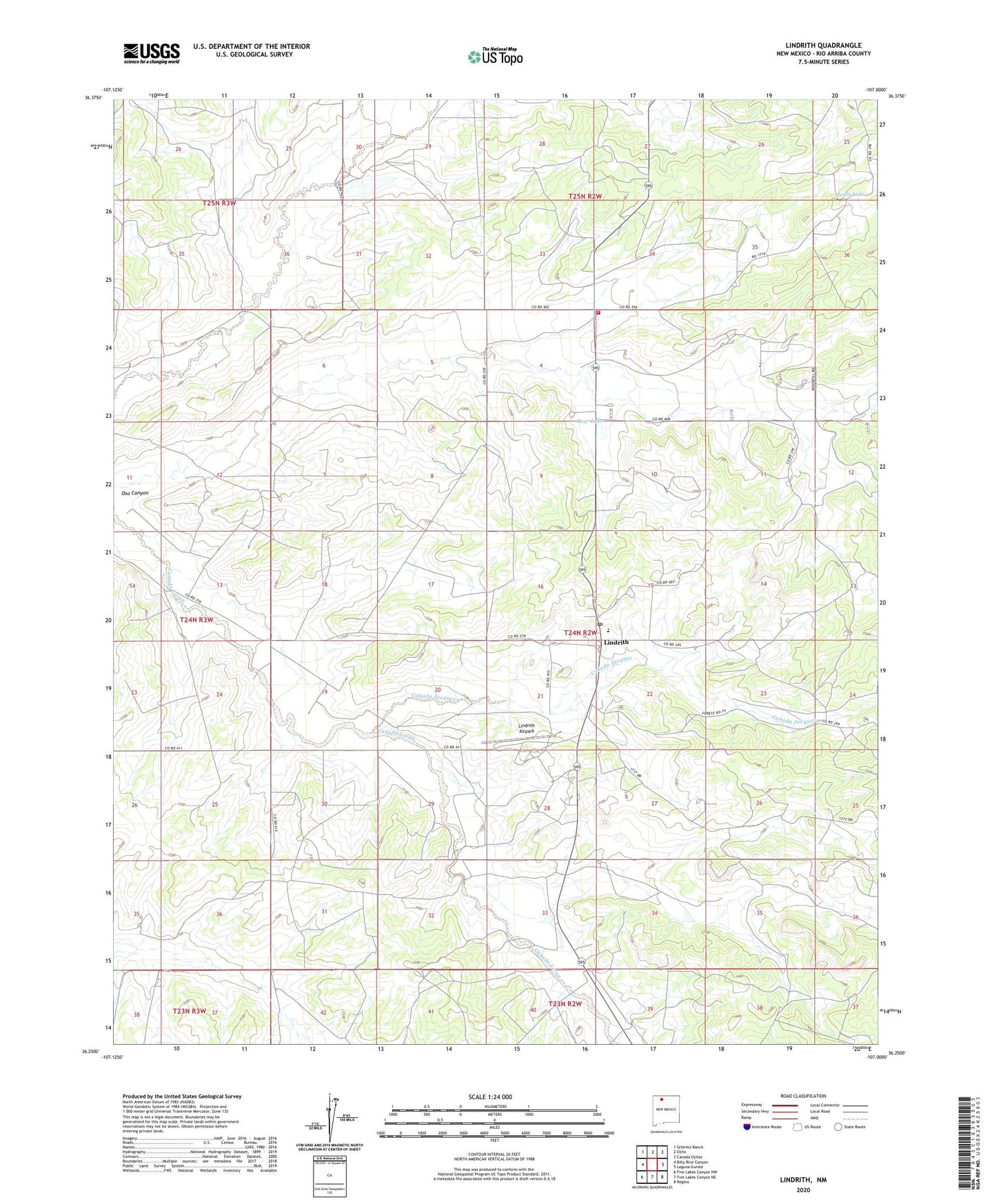
Lindrith New Mexico US Topo Map
Couldn't load pickup availability
Also explore the Lindrith Forest Service Topo of this same quad for updated USFS data
2023 topographic map quadrangle Lindrith in the state of New Mexico. Scale: 1:24000. Based on the newly updated USGS 7.5' US Topo map series, this map is in the following counties: Rio Arriba. The map contains contour data, water features, and other items you are used to seeing on USGS maps, but also has updated roads and other features. This is the next generation of topographic maps. Printed on high-quality waterproof paper with UV fade-resistant inks.
Quads adjacent to this one:
West: Billy Rice Canyon
Northwest: Schmitz Ranch
North: Ojito
Northeast: Canada Ojitos
East: Laguna Gurule
Southeast: Regina
South: Five Lakes Canyon NE
Southwest: Five Lakes Canyon NW
This map covers the same area as the classic USGS quad with code o36107c1.
Contains the following named places: Bear Lake, Canada Jacquez, Gavilan Lake, Humphries, Lindrith, Lindrith Airpark, Lindrith Census Designated Place, Lindrith Post Office, Lindrith Volunteer Fire Department, Monte Lake, OJ170 5 Water Well, Ojito 3 Water Well, Ojito 4 Water Well, Ojito Camp, Ojito Camp Water Well, Rebecca Velarde Water Well