MyTopo
Five Lakes Canyon NE New Mexico US Topo Map
Couldn't load pickup availability
Also explore the Five Lakes Canyon NE Forest Service Topo of this same quad for updated USFS data
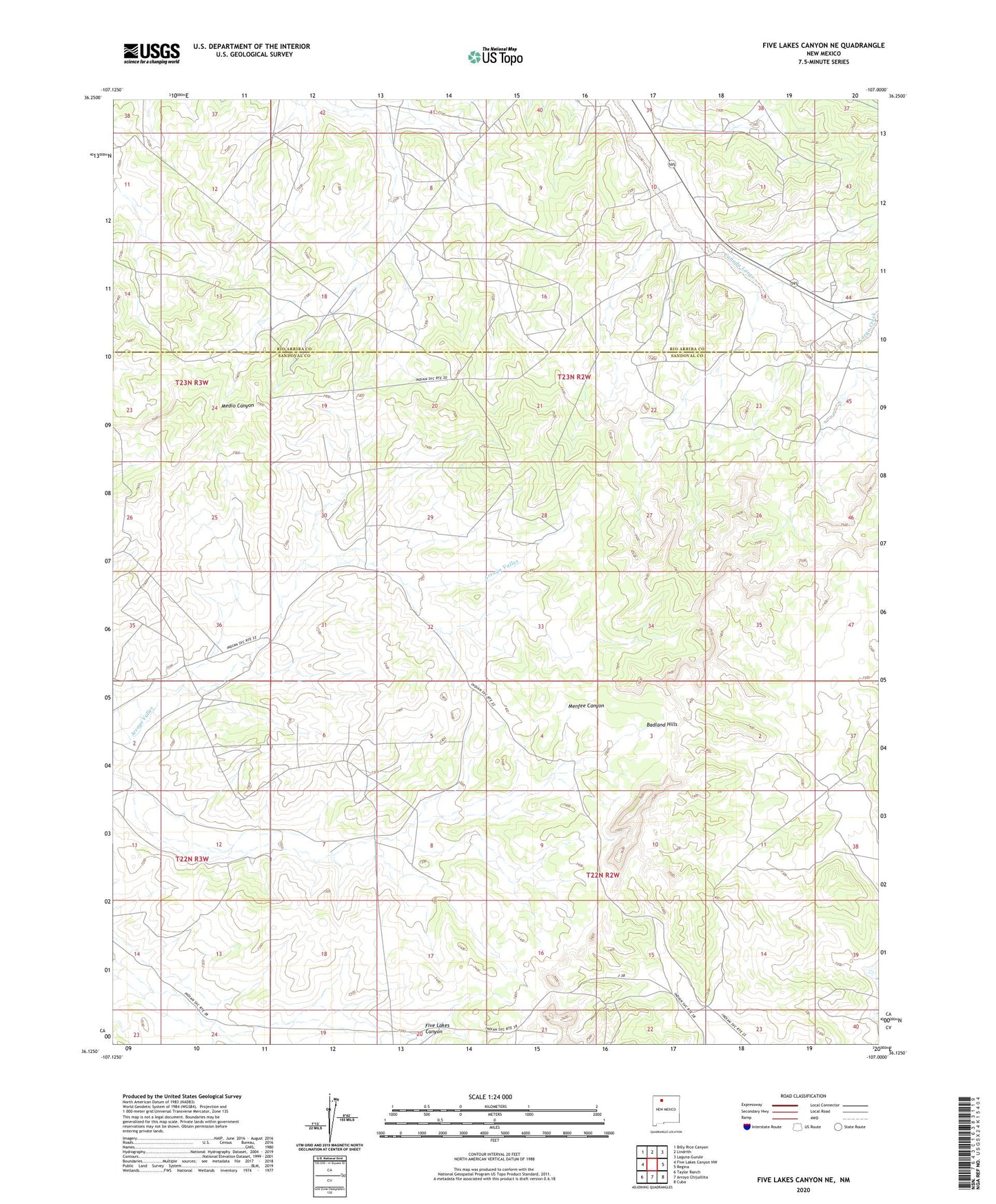
2023 topographic map quadrangle Five Lakes Canyon NE in the state of New Mexico. Scale: 1:24000. Based on the newly updated USGS 7.5' US Topo map series, this map is in the following counties: Sandoval, Rio Arriba. The map contains contour data, water features, and other items you are used to seeing on USGS maps, but also has updated roads and other features. This is the next generation of topographic maps. Printed on high-quality waterproof paper with UV fade-resistant inks.
Quads adjacent to this one:
West: Five Lakes Canyon NW
Northwest: Billy Rice Canyon
North: Lindrith
Northeast: Laguna Gurule
East: Regina
Southeast: Cuba
South: Arroyo Chijuillita
Southwest: Taylor Ranch
This map covers the same area as the classic USGS quad with code o36107b1.
Contains the following named places: Badland Hills, Four Corners Water Well, Johnson Water Well, Johnson Windmill Water Well, Largo Creek, Lindberg Velard Water Well, Taylor Monarco Water Well