MyTopo
Black Mesa New Mexico US Topo Map
Couldn't load pickup availability
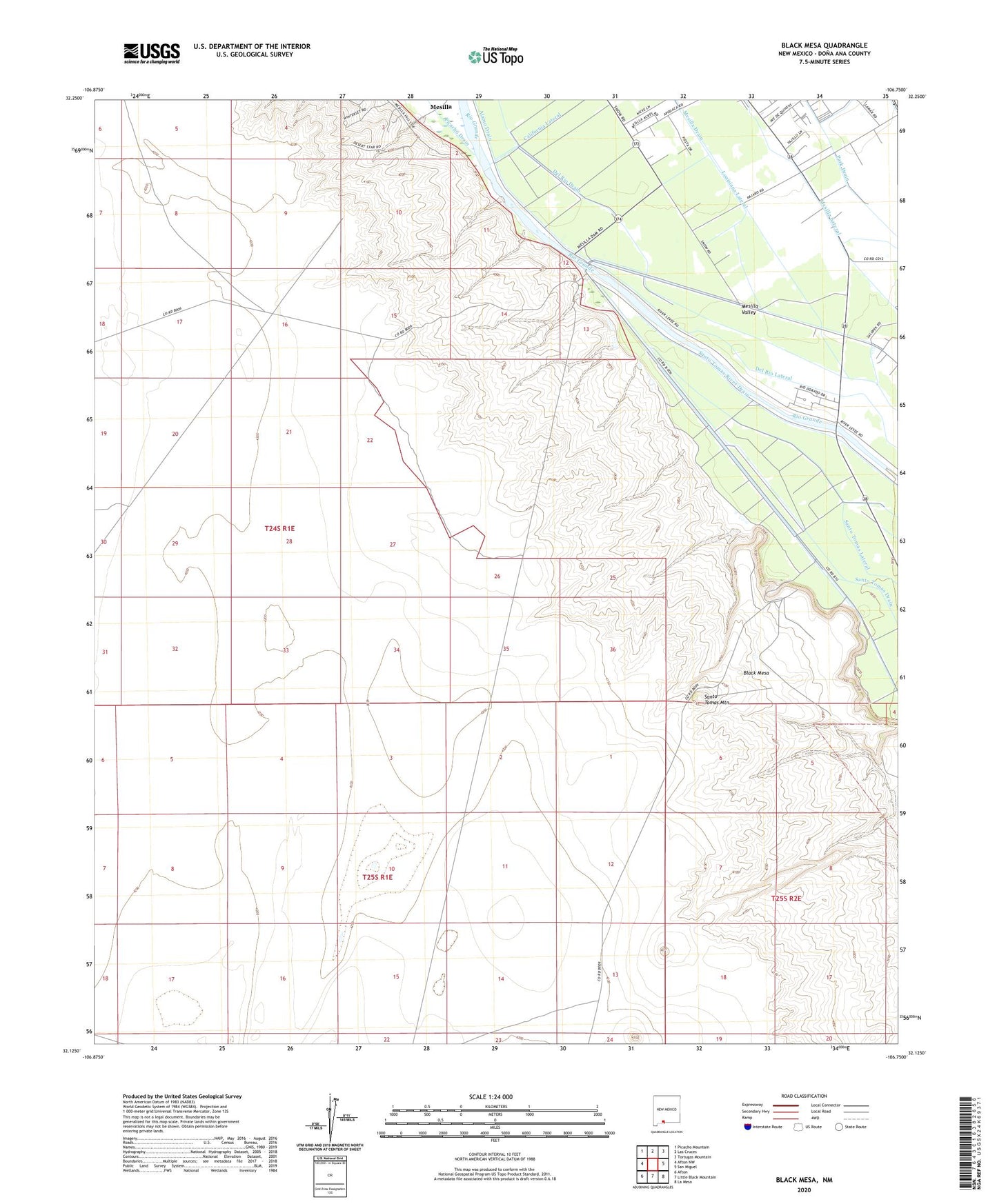
2023 topographic map quadrangle Black Mesa in the state of New Mexico. Scale: 1:24000. Based on the newly updated USGS 7.5' US Topo map series, this map is in the following counties: Doña Ana. The map contains contour data, water features, and other items you are used to seeing on USGS maps, but also has updated roads and other features. This is the next generation of topographic maps. Printed on high-quality waterproof paper with UV fade-resistant inks.
Quads adjacent to this one:
West: Afton NW
Northwest: Picacho Mountain
North: Las Cruces
Northeast: Tortugas Mountain
East: San Miguel
Southeast: La Mesa
South: Little Black Mountain
Southwest: Afton
This map covers the same area as the classic USGS quad with code o32106b7.
Contains the following named places: Black Mesa, Del Rio Drain, Del Rio Lateral, Louisiana Lateral, M-1A Water Well, M-1B Water Well, M-1C Water Well, M-2A Water Well, M-2B Water Well, M-2C Water Well, Mesilla Diversion Dam, Park Drain, San Pablo, Santo Tomas Lateral, Santo Tomas Mountain, United States Bureau of Reclamation 48 Water Well, ZIP Code: 88044