MyTopo
San Miguel New Mexico US Topo Map
Couldn't load pickup availability
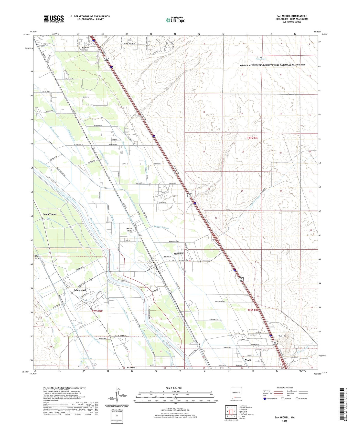
2023 topographic map quadrangle San Miguel in the state of New Mexico. Scale: 1:24000. Based on the newly updated USGS 7.5' US Topo map series, this map is in the following counties: Doña Ana. The map contains contour data, water features, and other items you are used to seeing on USGS maps, but also has updated roads and other features. This is the next generation of topographic maps. Printed on high-quality waterproof paper with UV fade-resistant inks.
Quads adjacent to this one:
West: Black Mesa
Northwest: Las Cruces
North: Tortugas Mountain
Northeast: Organ Peak
East: Bishop Cap
Southeast: Anthony
South: La Mesa
Southwest: Little Black Mountain
This map covers the same area as the classic USGS quad with code o32106b6.
Contains the following named places: 10034 Water Well, 10035 Water Well, 10062 Water Well, 88047, 88048, Apache Brazito Mesquite Site Four Dam, Apache Brazito Mesquite Site One Dam, Apache Brazito Mesquite Site Three Dam, Apache Brazito Mesquite Site Two Dam, Apache Lateral, Bannock Lateral, BR-1 Water Well, Brazito, Brazito Battlefield Historical Marker, Brazito Lateral, Brazito River Lateral, Brazito School, Brown Lateral, Butterfield Trail Historical Marker, Chamberino Main Lateral, Dominguez Dairy, Dona Ana County Fire Department - Station 10 Mesquite, East Side Canal, ED-1 Water Well, El Camino Real Historical Marker, Espejos Expedition on the Camino Real Historical Marker, Fillmore Arroyo, Fillmore Site Number Three Dam, Fillmore Site Number Two Dam, First Baptist Church, Franklin Mountains Historical Marker, GM-10 Water Well, GM-3 Water Well, GM-5 Water Well, GM-6 Water Well, GM-7 Water Well, GM-9 Water Well, Houghton Lateral, Jose Manuel Sanchez Baca, La Mesa Drain, La Mesa Lake, Lake Drain, Lake Lateral, Las Cruces Lateral, M-4A Water Well, M-4B Water Well, M-4C Water Well, Mesilla Civil Colony Grant, Mesquite, Mesquite Baptist Church, Mesquite Census Designated Place, Mesquite Drain, Mesquite Elementary School, Mesquite Post Office, Middle Lateral, Missionary Ridge Cemetery, Mossman Arroyo, Mossman Ranch, Mountain View Dairy, MW-2 Water Well, Onates Route on the Camnio Real Historical Marker, Price Daniel Well, Price Tank, Riverside Elementary School, Saint Michael Church, San Miguel, San Miguel Cemetery, San Miguel Census Designated Place, San Miguel Lateral, San Miguel Post Office, Santo Tomas, Santo Tomas De Yturbide Colony Tract Number 1, Santo Tomas Drain, Santo Tomas River Drain, Santo Tomas River Lateral, Sunland Park Elementary School, TW-10 Water Well, TW-9 Water Well, USBR 9 Water Well, Vado Arroyo, Vado Census Designated Place, Vado Hill, Vado Pit, Vado Quarry Number One, Vado Quarry Number Two, West Side Canal